| dc.contributor | Blaeu, Willem Janszoon, 1571-1638 | |
| dc.coverage.spatial | Africa | |
| dc.coverage.temporal | 1630 | |
| dc.date.accessioned | 2012-10-11T10:19:45Z | |
| dc.date.available | 2012-10-11T10:19:45Z | |
| dc.date.created | 1630 | |
| dc.identifier.other | Map no. 7 | |
| dc.identifier.uri | http://hdl.handle.net/10019.2/745 | |
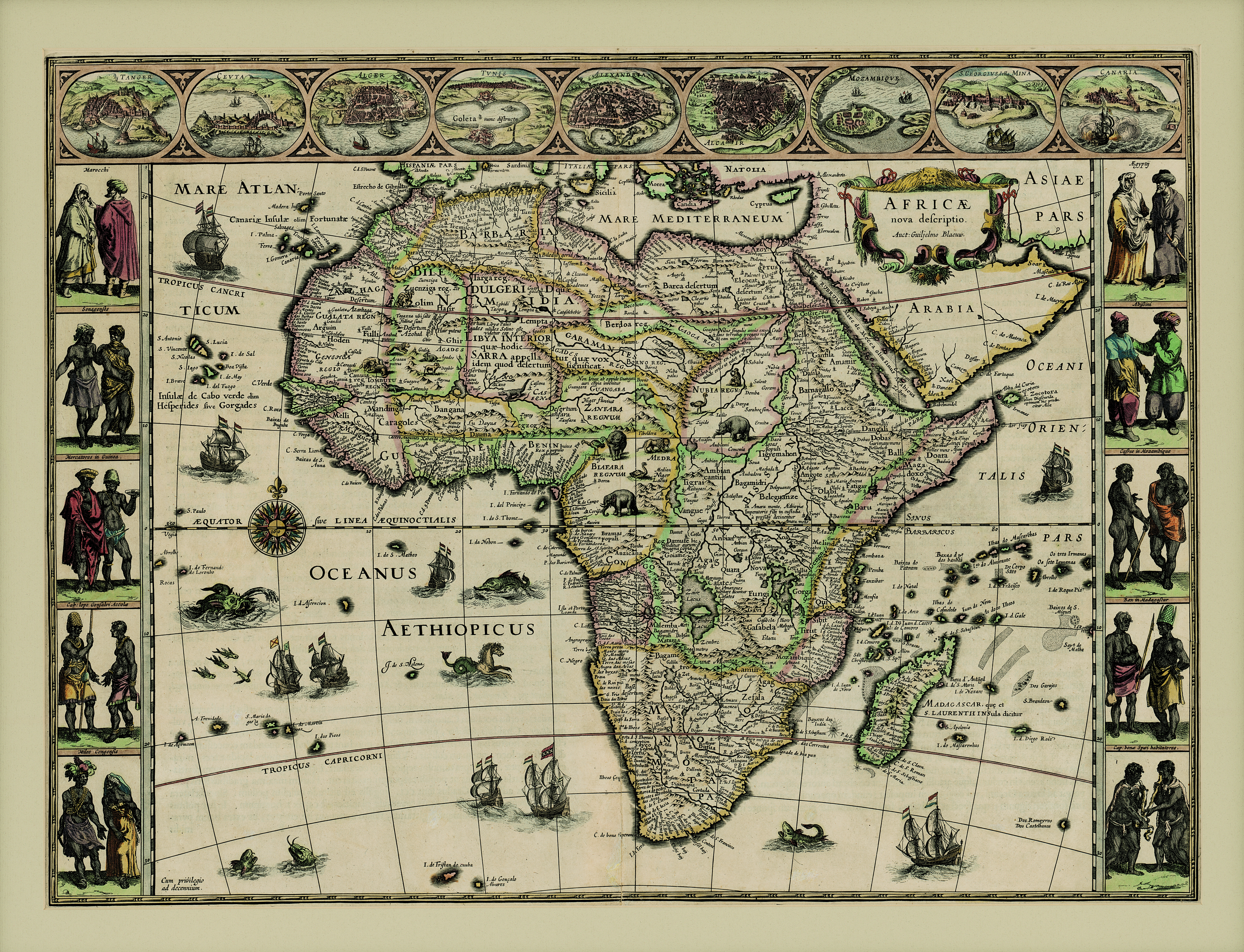
| dc.description.abstract | Coloured map.
Scale not given.
Latin text on the reverse (incomplete) differs from that of Atlas major pub. by his son Johan Blaeu in 1662. This map may be from an ed. of the Appendix theatri... first pub. in 1631, or from the Novus atlas pub. together with Johan Blaeu from 1634 onwards.
Includes side borders of pairs of costume figures and top border of vignette plans of 9 African cities. Map itself is decorated with ships, lions, etc. | |
| dc.format.extent | 41 x 55cm | |
| dc.language.iso | la | |
| dc.rights | This item is subject to copyright protection. Reproduction of the content, or any part of it, other than for research, academic or non-commercial use is prohibited without prior consent from the copyright holder. | |
| dc.source | Map from Hugh Solomon Collection, Africana. | |
| dc.subject | Africa -- Maps -- Early works to 1800 | en_ZA |
| dc.subject | Cartography -- Africa | en_ZA |
| dc.title | Africae nova descriptio | la |
| dc.type | Map | |
| dc.rights.holder | Copyright Stellenbosch University | |