| dc.contributor | Wit, Frederick (I) de, 1616-1689 | |
| dc.coverage.spatial | South Africa | |
| dc.coverage.temporal | 1860 | |
| dc.date.accessioned | 2012-10-11T10:19:46Z | |
| dc.date.available | 2012-10-11T10:19:46Z | |
| dc.date.created | 1860 | |
| dc.identifier.other | Map no. 45 | |
| dc.identifier.uri | http://hdl.handle.net/10019.2/776 | |
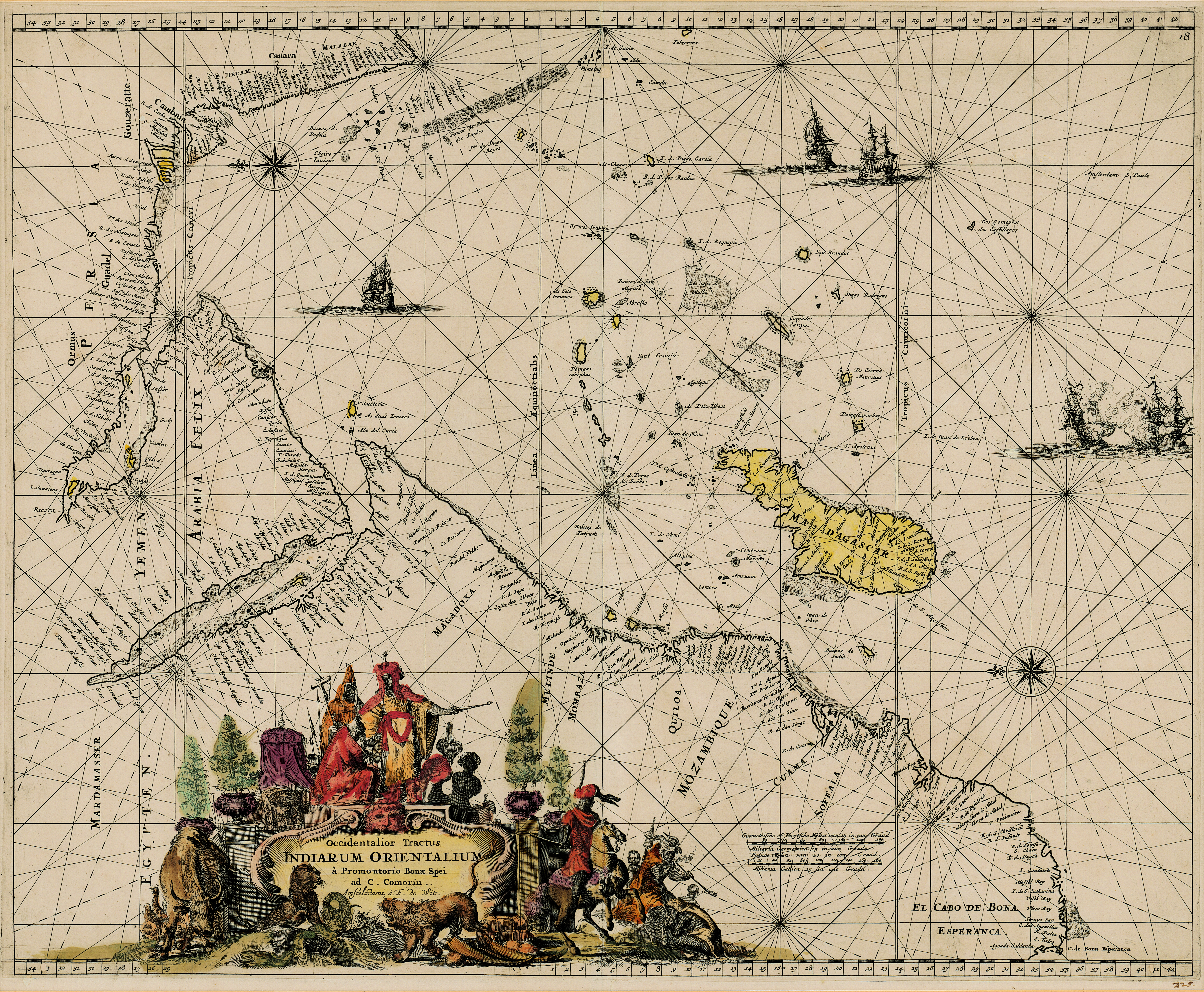
| dc.description.abstract | Coloured chart.
Line scale given.
col.chart 45x54cm.
Elaborate cartouche in bottom left corner with figures and animals.
Possibly from the sea atlas issued by de Wit c1680. | |
| dc.format.extent | 45 x 54cm | |
| dc.language.iso | la | |
| dc.publisher | F. de Wit | |
| dc.rights | This item is subject to copyright protection. Reproduction of the content, or any part of it, other than for research, academic or non-commercial use is prohibited without prior consent from the copyright holder. | |
| dc.source | Map from Hugh Solomon Collection, Africana. | |
| dc.subject | South Africa -- Maps -- Early works to 1800 | en_ZA |
| dc.subject | Cartography -- South Africa | en_ZA |
| dc.title | Occidentalior Tractus Indiarum Orientalium à Promontorio Bonae Spei ad C. Comorin | la |
| dc.type | Map | |
| dc.rights.holder | Copyright Stellenbosch University | |