| dc.contributor | Hall, Sidney, fl. 1817-1860 | |
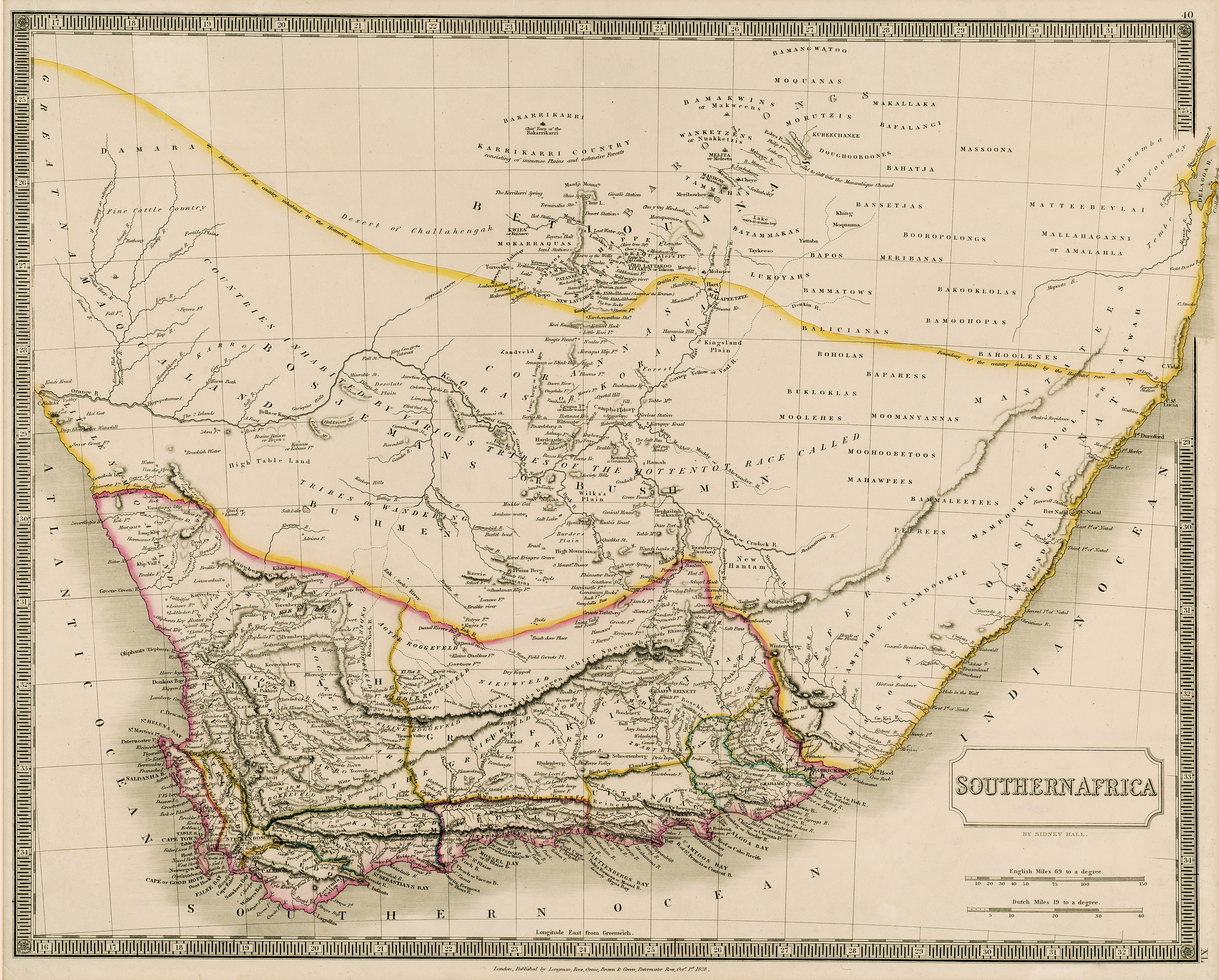
| dc.coverage.spatial | Southern Africa | |
| dc.coverage.temporal | 1828 | |
| dc.date.accessioned | 2012-10-11T10:19:47Z | |
| dc.date.available | 2012-10-11T10:19:47Z | |
| dc.date.created | 1828 | |
| dc.date.issued | 1828 | |
| dc.identifier.other | Map no. 58 | |
| dc.identifier.uri | http://hdl.handle.net/10019.2/789 | |
| dc.description.abstract | Coloured map.
Line scales given.
Page number [?] top right: 40; plate number [?] bottom right: XI. | |
| dc.format.extent | 41 x 51cm | |
| dc.language.iso | en | |
| dc.publisher | Longman, Rees, Orme, Brown & Green | |
| dc.rights | This item is subject to copyright protection. Reproduction of the content, or any part of it, other than for research, academic or non-commercial use is prohibited without prior consent from the copyright holder. | |
| dc.source | Map from Hugh Solomon Collection, Africana. | |
| dc.subject | Africa, Southern -- Maps -- Early works to 1800 | en_ZA |
| dc.subject | Cartography -- Africa, Southern | en_ZA |
| dc.title | Southern Africa | en |
| dc.type | Map | |
| dc.rights.holder | Copyright Stellenbosch University | |