| dc.contributor | De La Rochette, Louis Stanislas D'Arcy, 1731-1802 | |
| dc.coverage.spatial | Cape of Good Hope | |
| dc.coverage.temporal | 1782 | |
| dc.date.accessioned | 2012-10-11T10:19:47Z | |
| dc.date.available | 2012-10-11T10:19:47Z | |
| dc.date.created | 1782 | |
| dc.date.issued | 1782 | |
| dc.identifier.other | Map no. 81 | |
| dc.identifier.uri | http://hdl.handle.net/10019.2/792 | |
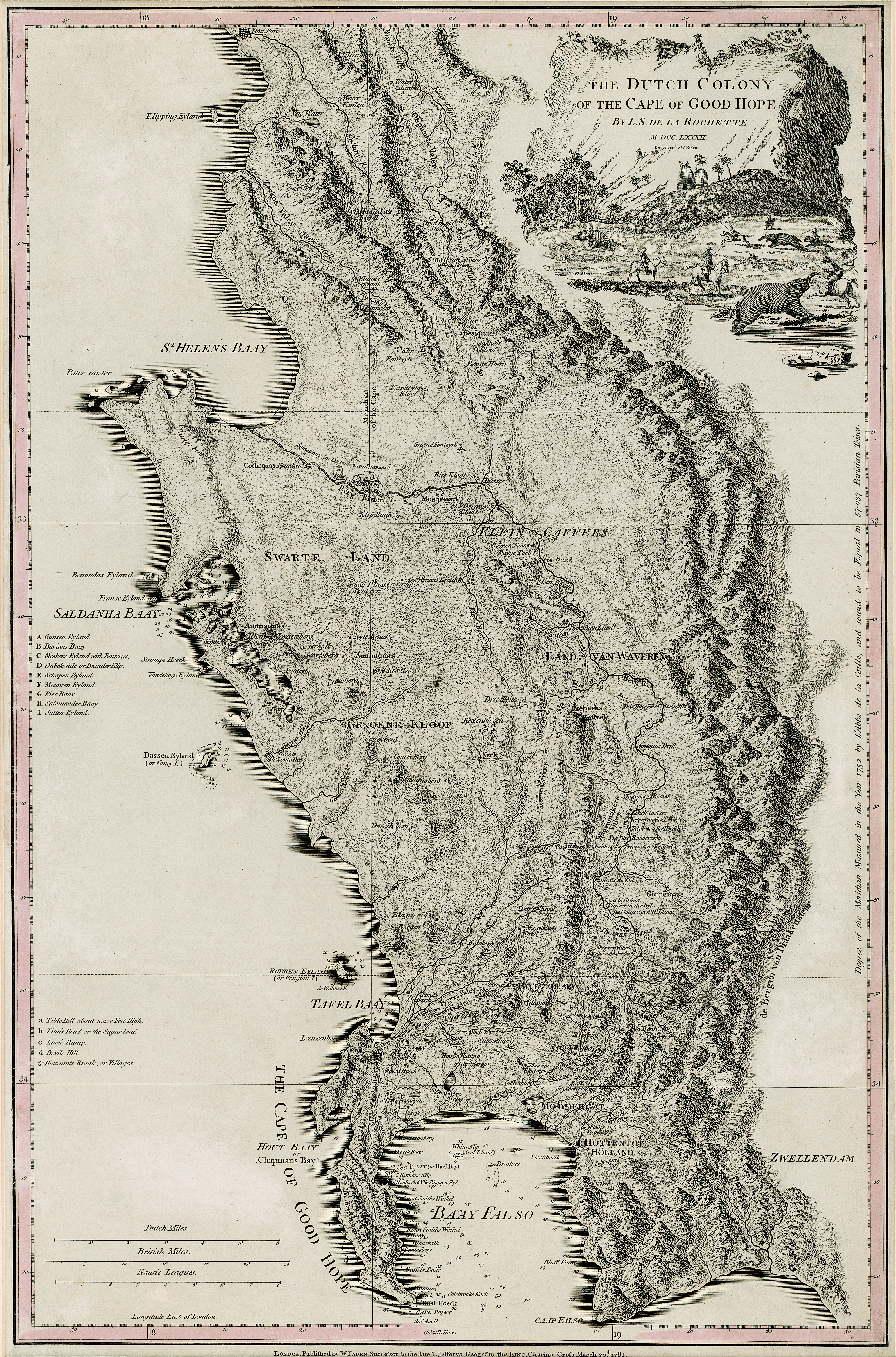
| dc.description.abstract | Map, coloured border.
Line scales given.
Depicts an area from Klipping Eyland to Caap Falso bounded on the east by the Draakenstein mountains.
Lettered table of place names on the left. | |
| dc.format.extent | 50,5 x 33cm | |
| dc.language.iso | en | |
| dc.publisher | W. Faden | |
| dc.rights | This item is subject to copyright protection. Reproduction of the content, or any part of it, other than for research, academic or non-commercial use is prohibited without prior consent from the copyright holder. | |
| dc.source | Map from Hugh Solomon Collection, Africana. | |
| dc.subject | Cape of Good Hope (South Africa) -- Maps | en_ZA |
| dc.subject | South Africa -- Maps -- Early works to 1800 | en_ZA |
| dc.subject | Cartography -- South Africa -- Cape of Good Hope | en_ZA |
| dc.title | The Dutch Colony of the Cape of Good Hope | en |
| dc.type | Map | |
| dc.rights.holder | Copyright Stellenbosch University | |