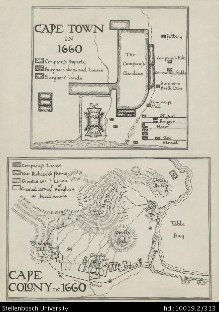
Cape Town in 1660
Cape Colony in 1660
View/
Rights
This item is subject to copyright protection. Reproduction of the content, or any part of it, other than for research, academic or non-commercial use is prohibited without prior consent from the copyright holder.Copyright James Walton
Metadata
Show full item recordAbstract
Drawing of a plan of Cape Town in 1660, depicting detail of the Company's Gardens (property, kiln, stable, mill), the Burghers (lands, brick kiln, shops and houses), pottery, a fort, a kraal, a stable, Olifant Street, Reyger Street, Heere Street and Zee Street. Drawing of a map of the Cape Colony in 1660, depicting detail of the Company's lands, Van Riebeeck's farms, lands of Burghers (granted 1657 and 1657-60), blockhouses, Table Mountain, Lion's Rump, Wynberg Hill, Groote Schuur, Devil's Peak, Liesbeeck River, Table Bay, a fort, a pole and a fence.
Collections
- James Walton Collection [885]