Map of the Lands of the Voortrekkers
View/
Date Created
1951Rights
This item is subject to copyright protection. Reproduction of the content, or any part of it, other than for research, academic or non-commercial use is prohibited without prior consent from the copyright holder.Copyright James Walton
Metadata
Show full item recordAbstract
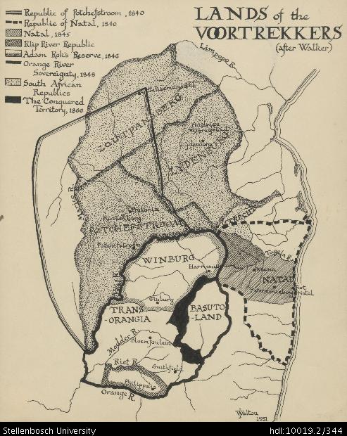
Drawing of a map of the lands of the Voortrekkers, depicting the Orange River, Philippolis, Riet River, Smithfield, Modder River, Transorangia, Winburg, Basutoland, Vaal River, Winburg, Harrismith, Pietermaritzburg, Port Natal, Natal, Weenen, Tugela River, Potchefstroom, Rustenberg, Pretoria, Utrecht, Marico River, Lydenburg, Andries Ohrigstad, Zoutpansberg, Schoemansdal and Limpopo River. The map also depicts detail of the Republic of Potchefstroom (1840), the Republic of Natal (1840), Natal (1845), Klip River Republic, Adam Kok's Reserve (1846), the Orange River Sovereignty (1848), the South African Republics and the Conquered Territory (1866).
Collections
- James Walton Collection [885]