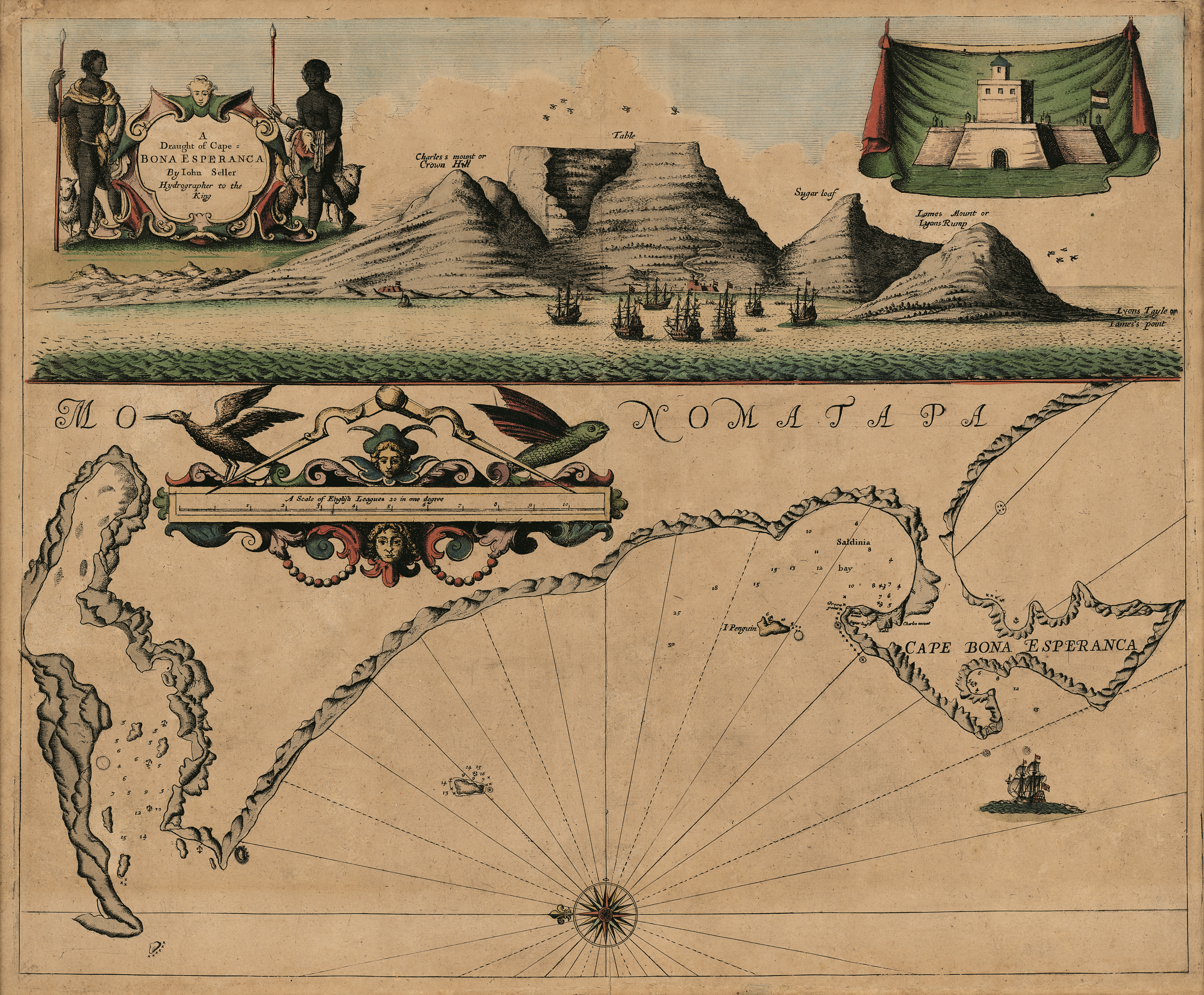
A draught of Cape Bona Esperanca
View/
Date Created
1675Format Extent
45 x 54cmRights
This item is subject to copyright protection. Reproduction of the content, or any part of it, other than for research, academic or non-commercial use is prohibited without prior consent from the copyright holder.Copyright Stellenbosch University
Metadata
Show full item recordAbstract
Coloured chart.
Line scale given.
Title within decorated cartouche is in top left corner & in top right is an inset of a fort; running across the top of the map is a view of Table Bay. Map has a large decorative scale in English leagues.
First appeared in J. Seller: Third book of the English Pilot, 1675.