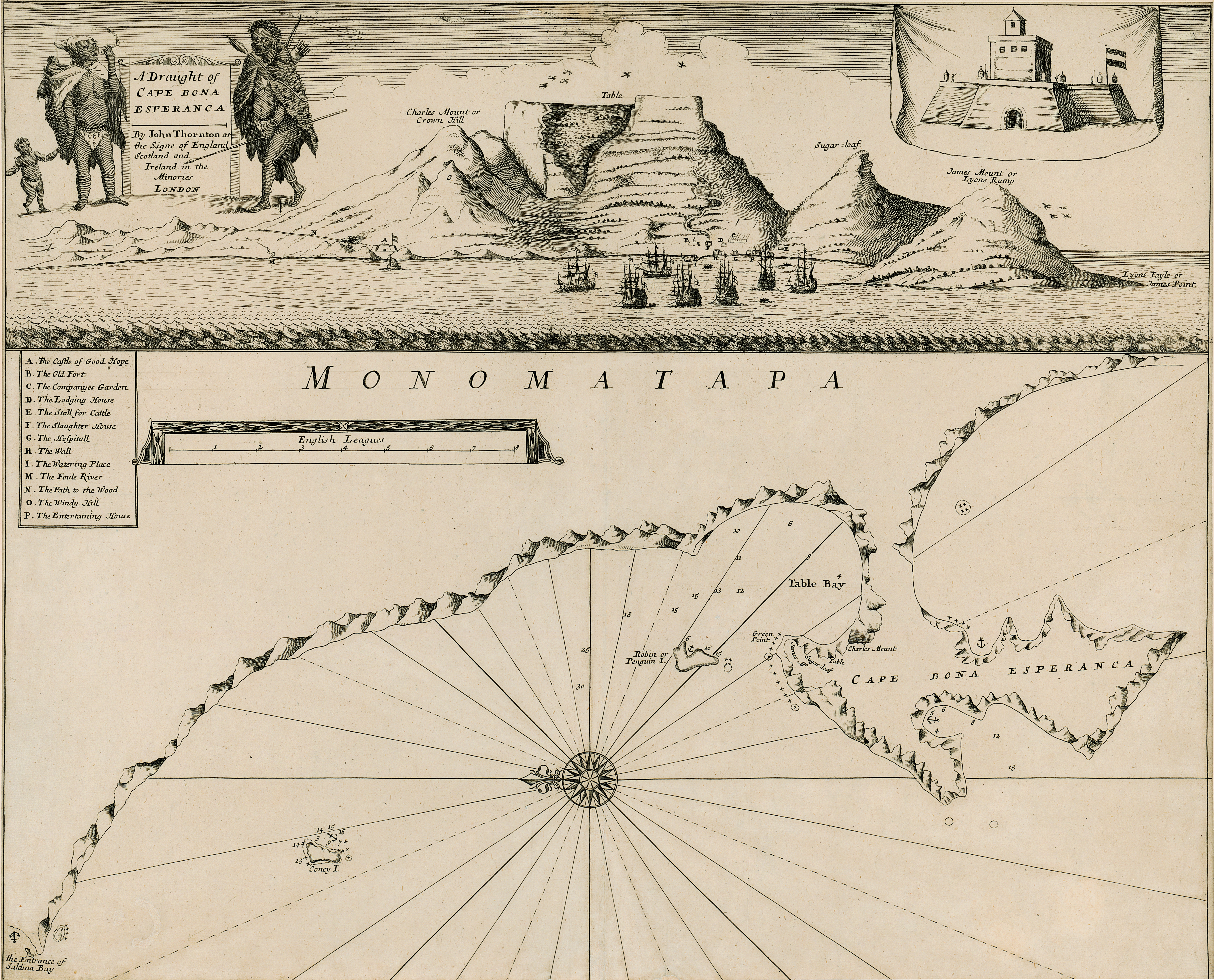
A draught of Cape Bona Esperanca
View/
Date Created
1675-1703Format Extent
44 x 53cmRights
This item is subject to copyright protection. Reproduction of the content, or any part of it, other than for research, academic or non-commercial use is prohibited without prior consent from the copyright holder.Copyright Stellenbosch University
Metadata
Show full item recordAbstract
Chart.
Line scale given.
This map with some changes is a new ed. of that issued by John Seller in 1675. Seller & Thornton collaborated from 1675 onwards & produced several works including “The English pilot" in which this map appears in 1703.
Title cartouche top left is new & has 2 figures of natives, the one on left with 2 children smoking a pipe; figure on the right has a spear & arrows. The view of Table Bay & the Fort across the top of the map are the same. The map is redrawn; the scale is in a simple frame & a key A-P is added.