| dc.contributor | Lichtenstein, Hinrich, 1780-1857 | |
| dc.coverage.spatial | Cape of Good Hope | |
| dc.coverage.temporal | 1815 | |
| dc.date.accessioned | 2012-10-11T10:19:48Z | |
| dc.date.available | 2012-10-11T10:19:48Z | |
| dc.date.created | 1815 | |
| dc.date.issued | 1815 | |
| dc.identifier.other | Map G | |
| dc.identifier.uri | http://hdl.handle.net/10019.2/812 | |
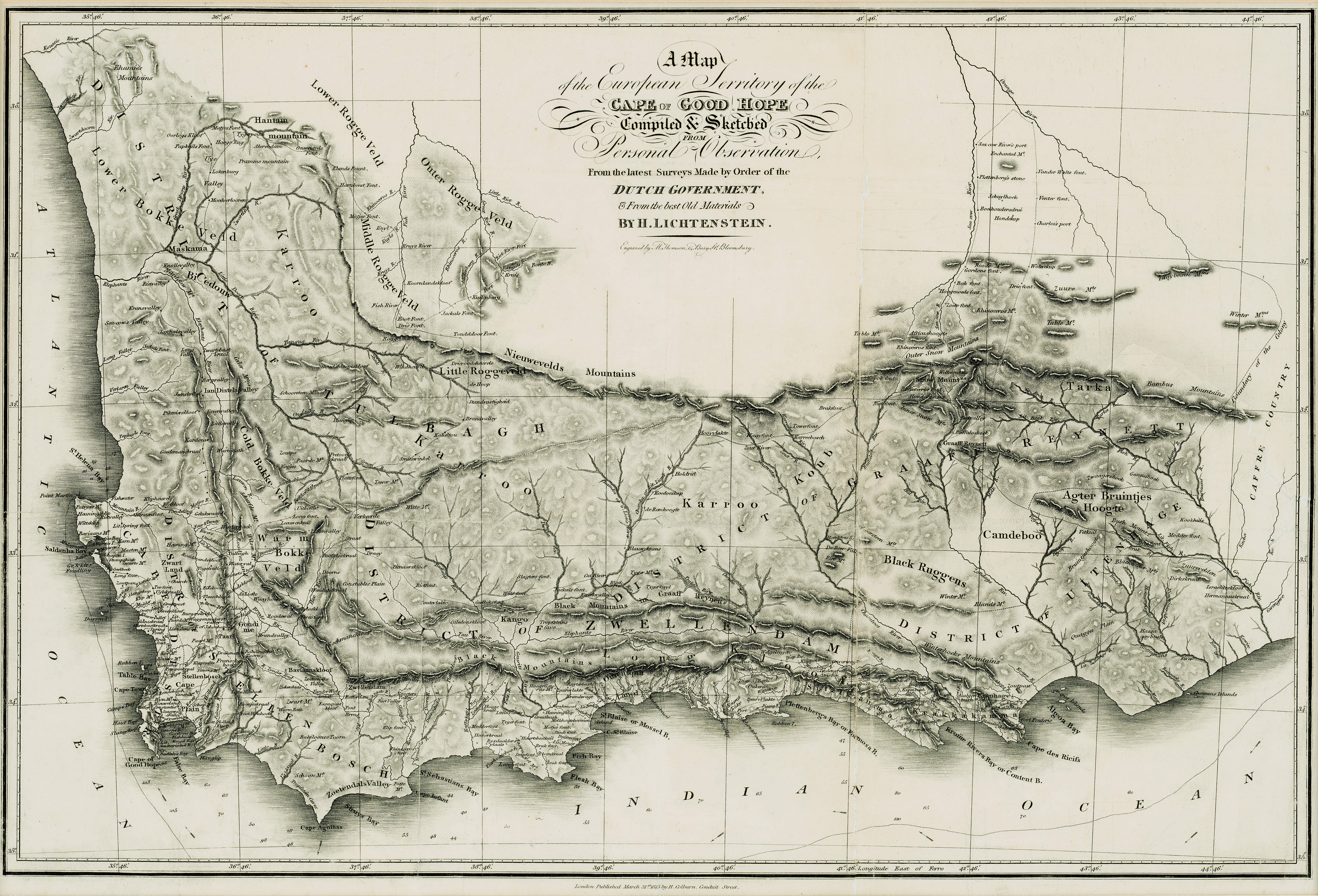
| dc.description | This map was originally published in volume two of Travels in Southern Africa, in the years 1803, 1804, 1805, and 1806 by Henry Lichtenstein; translated from the original German, by Anne Plumptre. London : Colburn, 1812-1815. | |
| dc.description.abstract | Map of the Cape of Good Hope. | |
| dc.language.iso | en | |
| dc.publisher | H. Colburn | |
| dc.rights | This item is subject to copyright protection. Reproduction of the content, or any part of it, other than for research, academic or non-commercial use is prohibited without prior consent from the copyright holder. | |
| dc.source | Map from Hugh Solomon Collection, Africana. | |
| dc.subject | Cape of Good Hope (South Africa) -- Maps | en_ZA |
| dc.subject | South Africa -- Maps -- Early works to 1800 | en_ZA |
| dc.subject | Cartography -- South Africa -- Cape of Good Hope | en_ZA |
| dc.title | A map of the European territory of the Cape of Good Hope | en |
| dc.type | Map | |
| dc.rights.holder | Copyright Stellenbosch University | |