| dc.coverage.spatial | South Africa | |
| dc.coverage.temporal | 1740 | |
| dc.date.accessioned | 2012-10-11T10:19:48Z | |
| dc.date.available | 2012-10-11T10:19:48Z | |
| dc.date.created | 1740 | |
| dc.identifier.other | Map no. 44 | |
| dc.identifier.uri | http://hdl.handle.net/10019.2/816 | |
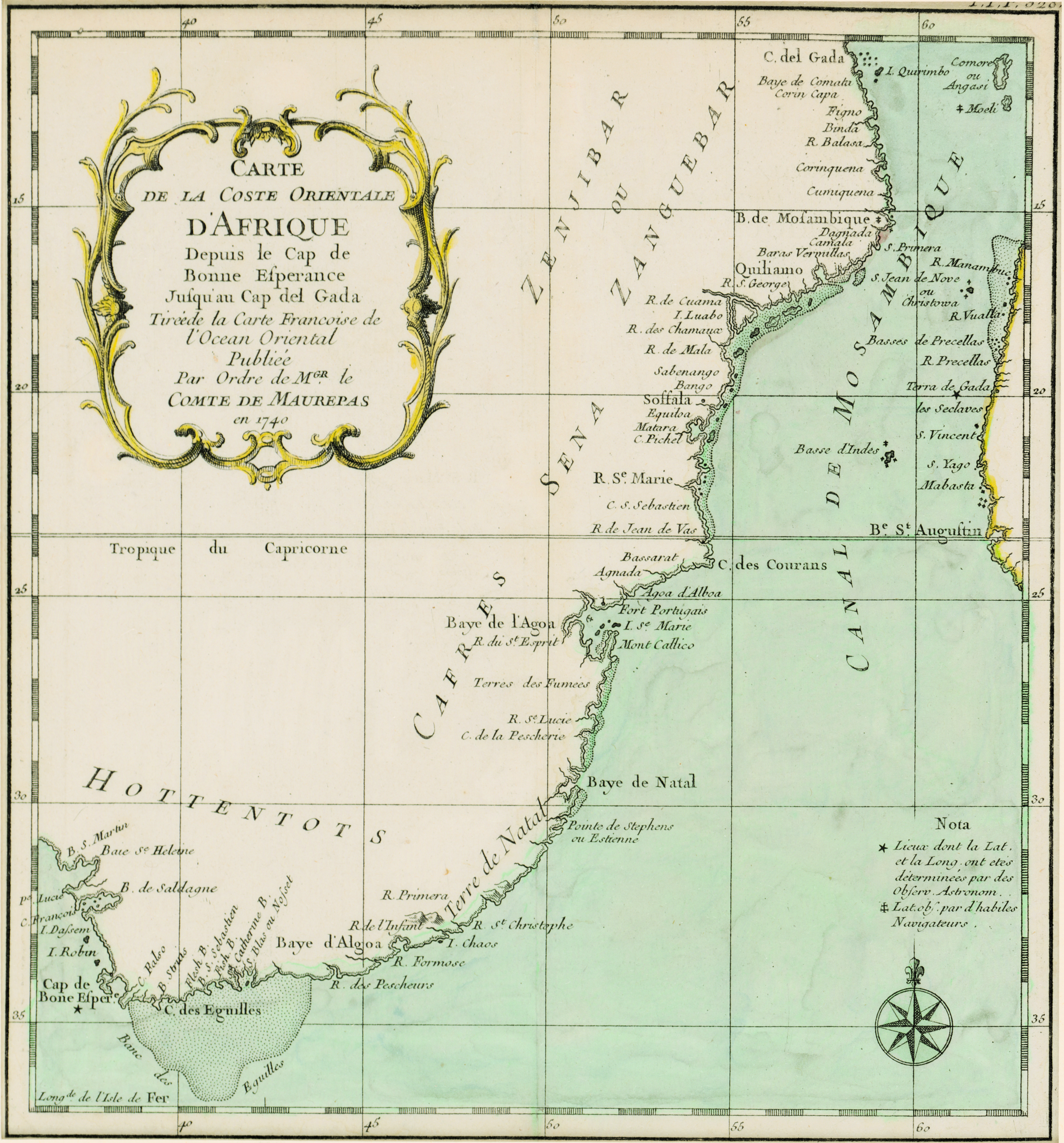
| dc.description.abstract | Unidentified coloured chart.
Scale not given.
Cartouche is a design in simple scroll work & an 8 point compass rose in the right hand lower corner is the only decoration.
Longitude of the "Isle de Fer" is noted in the lower left hand corner, & on the right is a "Nota" on longitude & latitude.
This map is noted as unidentified in Johannesburg Pub. Lib.: Exhibition of decorative maps of Africa up to 1800, 1952, descriptive catalogue, p.133. It is noted however, that the watermark is such as was used in 18th century France. | |
| dc.format.extent | 25 x 23cm | |
| dc.language.iso | fr | |
| dc.rights | This item is subject to copyright protection. Reproduction of the content, or any part of it, other than for research, academic or non-commercial use is prohibited without prior consent from the copyright holder. | |
| dc.source | Map from Hugh Solomon Collection, Africana. | |
| dc.subject | South Africa -- Maps -- Early works to 1800 | en_ZA |
| dc.subject | Cartography -- South Africa | en_ZA |
| dc.title | Carte de la coste orientale d'Afrique | fr |
| dc.type | Map | |
| dc.rights.holder | Copyright Stellenbosch University | |