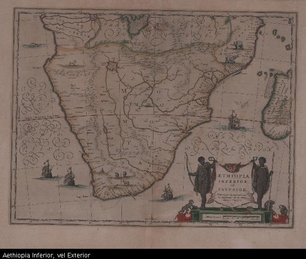
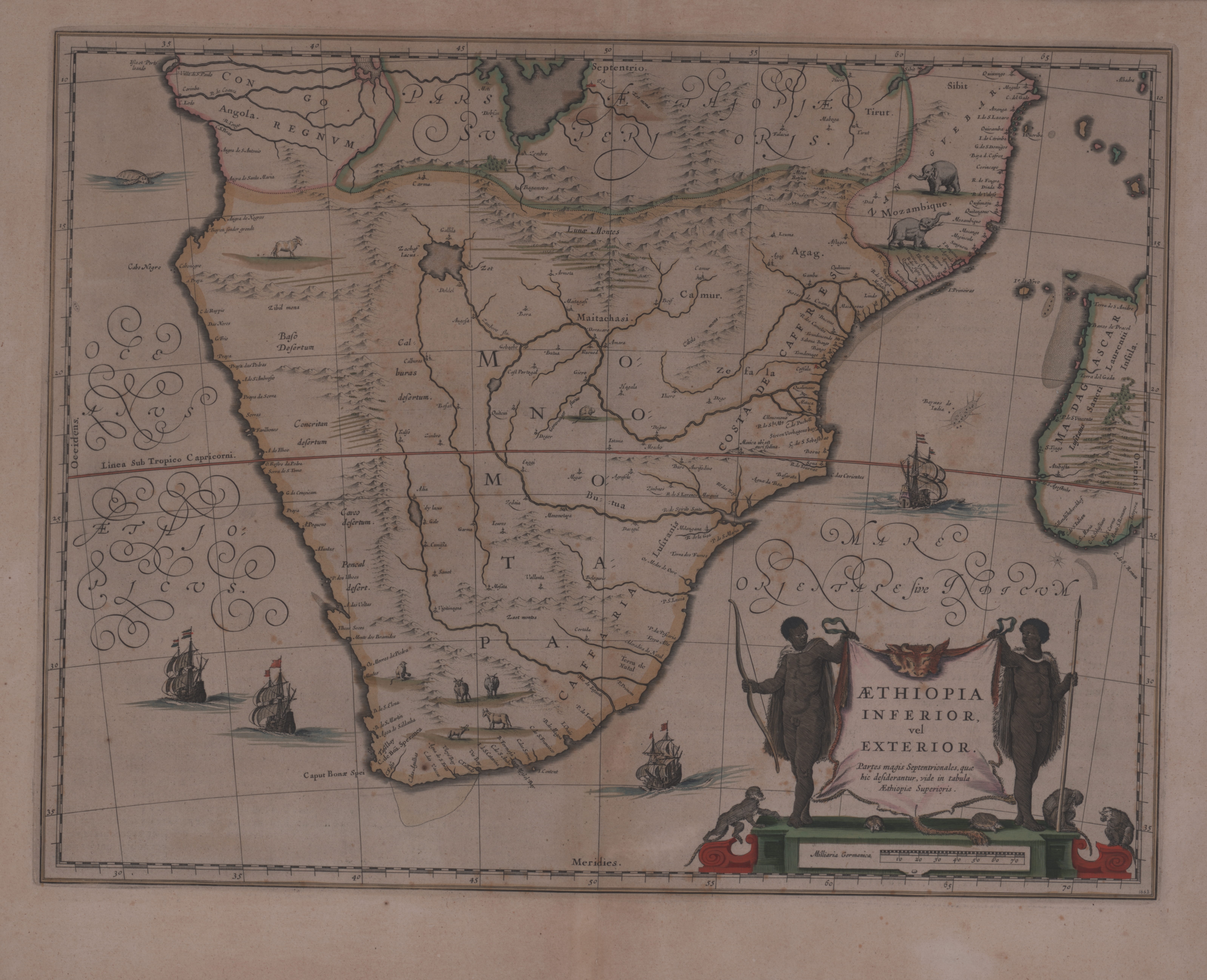
Aethiopia Inferior, vel Exterior
View/
Date Created
1663Format Extent
38 x 50cmRights
This item is subject to copyright protection. Reproduction of the content, or any part of it, other than for research, academic or non-commercial use is prohibited without prior consent from the copyright holder.Copyright Stellenbosch University
Metadata
Show full item recordAbstract
Coloured map.
Line scale given.
Title cartouche in bottom right corner, on ox skin supported by 2 natives with tortoises and monkeys at the foot. Two ships are shown off the west coast & 2 more off the east coast.
This map was first issued by William Blaeu in 1635 & this copy is from the French ed. of the 12v. atlas (Atlas Maior or Le Grand atlas) published by his sons Johan & Cornelis after his death; the first French ed. appeared in 1663 & a 2nd ed. In 1667.
French text on reverse.
Joan Jansson published almost exactly the same map in 1640.