| dc.contributor | Blaeu, Willem Janszoon, 1571-1638 | |
| dc.coverage.spatial | Southern Africa | |
| dc.coverage.temporal | 1663 | |
| dc.date.accessioned | 2012-10-11T10:19:48Z | |
| dc.date.available | 2012-10-11T10:19:48Z | |
| dc.date.created | 1663 | |
| dc.identifier.other | Map no. 52 | |
| dc.identifier.uri | http://hdl.handle.net/10019.2/823 | |
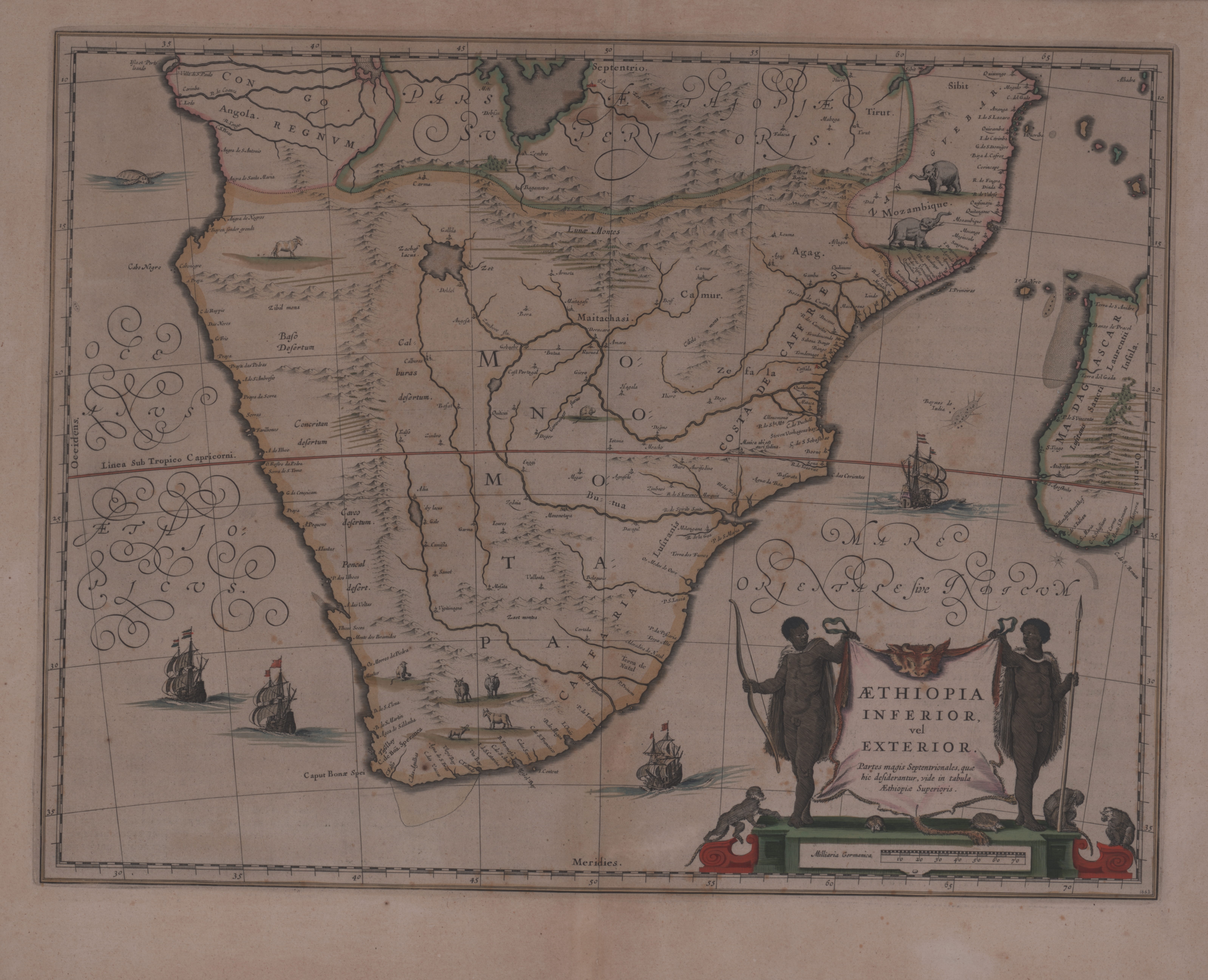
| dc.description.abstract | Coloured map.
Line scale given.
Title cartouche in bottom right corner, on ox skin supported by 2 natives with tortoises and monkeys at the foot. Two ships are shown off the west coast & 2 more off the east coast.
This map was first issued by William Blaeu in 1635 & this copy is from the French ed. of the 12v. atlas (Atlas Maior or Le Grand atlas) published by his sons Johan & Cornelis after his death; the first French ed. appeared in 1663 & a 2nd ed. In 1667.
French text on reverse.
Joan Jansson published almost exactly the same map in 1640. | |
| dc.format.extent | 38 x 50cm | |
| dc.language.iso | la | |
| dc.rights | This item is subject to copyright protection. Reproduction of the content, or any part of it, other than for research, academic or non-commercial use is prohibited without prior consent from the copyright holder. | |
| dc.source | Map from Hugh Solomon Collection, Africana. | |
| dc.subject | Ethiopia -- Maps -- Early works to 1800 | en_ZA |
| dc.subject | Cartography -- Ethiopia | en_ZA |
| dc.subject | Africa, Southern -- Maps -- Early works to 1800 | en_ZA |
| dc.title | Aethiopia Inferior, vel Exterior | la |
| dc.type | Map | |
| dc.rights.holder | Copyright Stellenbosch University | |