• Login
    View Item 
    •   SUNDigital Collections
    • Images
    • Hugh Solomon Map Collection
    • View Item
    •   SUNDigital Collections
    • Images
    • Hugh Solomon Map Collection
    • View Item
    JavaScript is disabled for your browser. Some features of this site may not work without it.

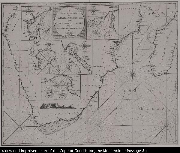
    A new and improved chart of the Cape of Good Hope, the Mozambique Passage & c.
    Thumbnail
    View/Open
    map-59.jpg (36.12Mb)
    Author
    Stephenson, J.
    Norie, J.
    Stuart, James
    Smith, J.
    Kruger, S.
    Dampier, William, 1652-1715
    Douglas
    Heather, William, 1764-1812
    Date Created
    1796
    Format Extent
    64 x 79cm
    Rights
    This item is subject to copyright protection. Reproduction of the content, or any part of it, other than for research, academic or non-commercial use is prohibited without prior consent from the copyright holder.
    Copyright Stellenbosch University
    Metadata
    Show full item record
    Abstract
    Chart. At foot, bottom left: Drawn by J. Norie, Teacher of Navigation, No. 157, Leadenhall Street. Insets: 5, and below them "A View of the Cape of Good Hope"; 1, A New Chart of Delagoa Bay, by Mr. James Stuart. - 2,... St. Augustines Bay, by Captain J. Smith. - 3, False Bay by Captain S. Kruger. - 4... Saldanha Bay by Captain Dampierre. 5,... Table Bay by Captain Douglas. Line scales given.
    URI
    http://hdl.handle.net/10019.2/827
    Collections
    • Hugh Solomon Map Collection [97]

    DSpace software copyright © 2002-2016  DuraSpace
    Contact Us
    Theme by 
    Atmire NV


    Browse

    All of SUNDigital CollectionsCommunities & CollectionsBy Issue DateAuthorsTitlesSubjectsBy Date CreatedThis CollectionBy Issue DateAuthorsTitlesSubjectsBy Date Created

    My Account

    LoginRegister

    Statistics

    View Usage Statistics

    DSpace software copyright © 2002-2016  DuraSpace
    Contact Us
    Theme by 
    Atmire NV