| dc.contributor | Moll, Herman, d.1732 | |
| dc.coverage.spatial | St. Helena | |
| dc.coverage.temporal | 1732 | |
| dc.date.accessioned | 2012-10-11T10:19:49Z | |
| dc.date.available | 2012-10-11T10:19:49Z | |
| dc.date.created | 1732 | |
| dc.identifier.other | Map no. 62 | |
| dc.identifier.uri | http://hdl.handle.net/10019.2/834 | |
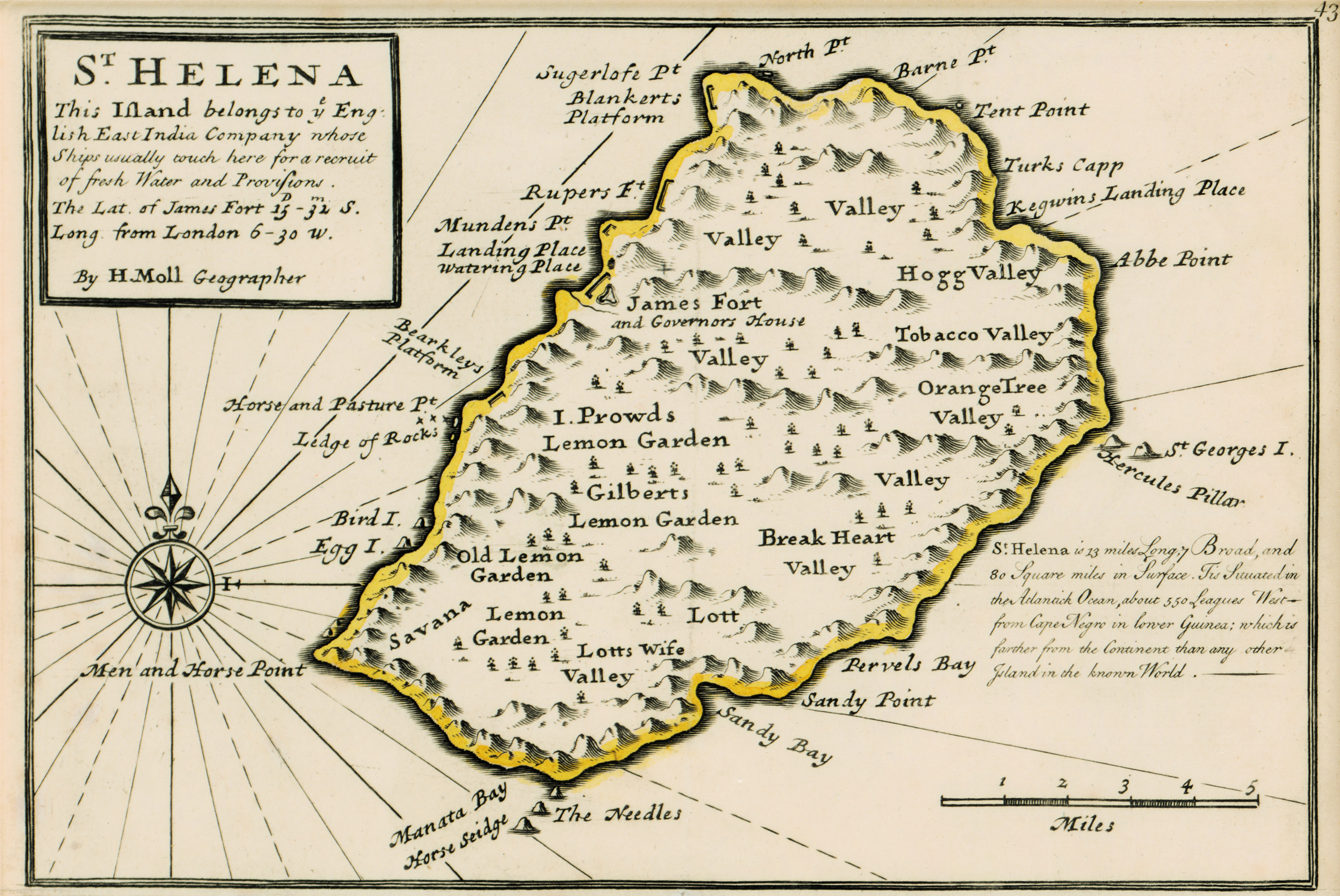
| dc.description.abstract | Coloured map on sheet.
Line scale given.
Upper half of a sheet with "The Bay of Agoa de Saldanha..."
Page number top right, 43.
Appeared in eds. pub. 1729-1735 of H. Moll's "Atlas minor."
1732 is written in pencil in bottom left corner. | |
| dc.format.extent | 14 x 20cm | |
| dc.language.iso | en | |
| dc.rights | This item is subject to copyright protection. Reproduction of the content, or any part of it, other than for research, academic or non-commercial use is prohibited without prior consent from the copyright holder. | |
| dc.source | Map from Hugh Solomon Collection, Africana. | |
| dc.subject | Saint Helena -- Maps -- Early works to 1800 | en_ZA |
| dc.subject | Cartography -- Saint Helena | en_ZA |
| dc.title | St. Helena | en |
| dc.type | Map | |
| dc.rights.holder | Copyright Stellenbosch University | |