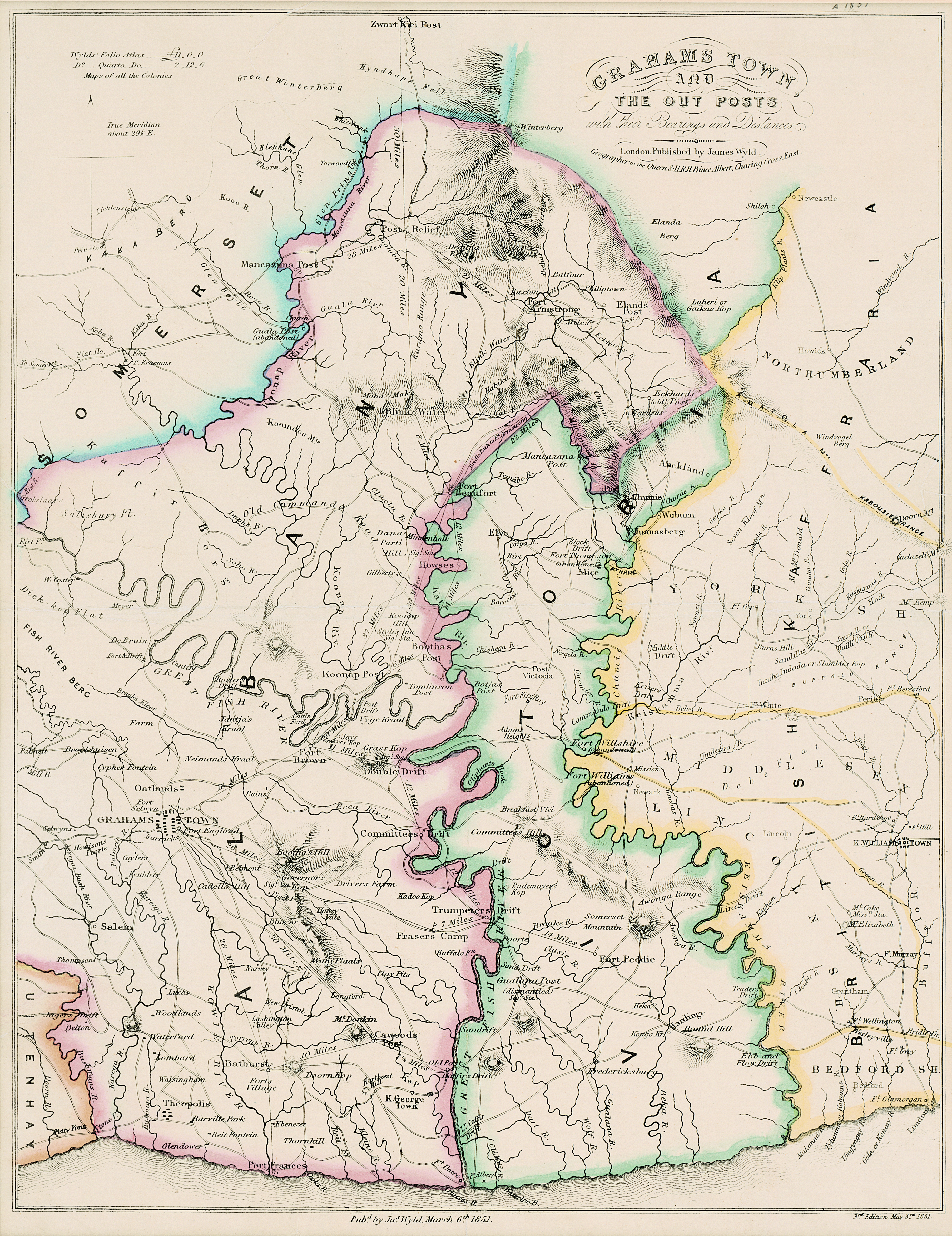
| dc.contributor | Wyld, James, 1812-1887 | |
| dc.coverage.spatial | Grahamstown | |
| dc.coverage.temporal | 1851 | |
| dc.date.accessioned | 2012-10-11T10:19:49Z | |
| dc.date.available | 2012-10-11T10:19:49Z | |
| dc.date.created | 1851 | |
| dc.date.issued | 1851 | |
| dc.identifier.other | Map no. 93 | |
| dc.identifier.uri | http://hdl.handle.net/10019.2/844 | |
| dc.description.abstract | Coloured map.
London. Published by James Wyld. Geographer to the Queen & H.R.H. Prince Albert, Charing Cross East. 3rd edition May 3rd., 1851.
Below map: Pubd. by Jas. Wyld. March 6th. 1851. | |
| dc.format.extent | 40 x 31cm | |
| dc.language.iso | en | |
| dc.publisher | James Wyld | |
| dc.rights | This item is subject to copyright protection. Reproduction of the content, or any part of it, other than for research, academic or non-commercial use is prohibited without prior consent from the copyright holder. | |
| dc.source | Map from Hugh Solomon Collection, Africana. | |
| dc.subject | South Africa -- Maps -- Early works to 1800 | en_ZA |
| dc.subject | Cartography -- South Africa -- Grahamstown | en_ZA |
| dc.subject | Grahamstown (South Africa) -- Maps | en_ZA |
| dc.title | Grahams Town and the out posts | en |
| dc.type | Map | |
| dc.rights.holder | Copyright Stellenbosch University | |