| dc.contributor | Bowles, Carington, 1724-1793 | |
| dc.coverage.spatial | Africa | |
| dc.coverage.temporal | 1779-1793 | |
| dc.date.accessioned | 2012-10-11T10:19:45Z | |
| dc.date.available | 2012-10-11T10:19:45Z | |
| dc.date.created | 1779-1793 | |
| dc.identifier.other | Map no. 10 | |
| dc.identifier.uri | http://hdl.handle.net/10019.2/746 | |
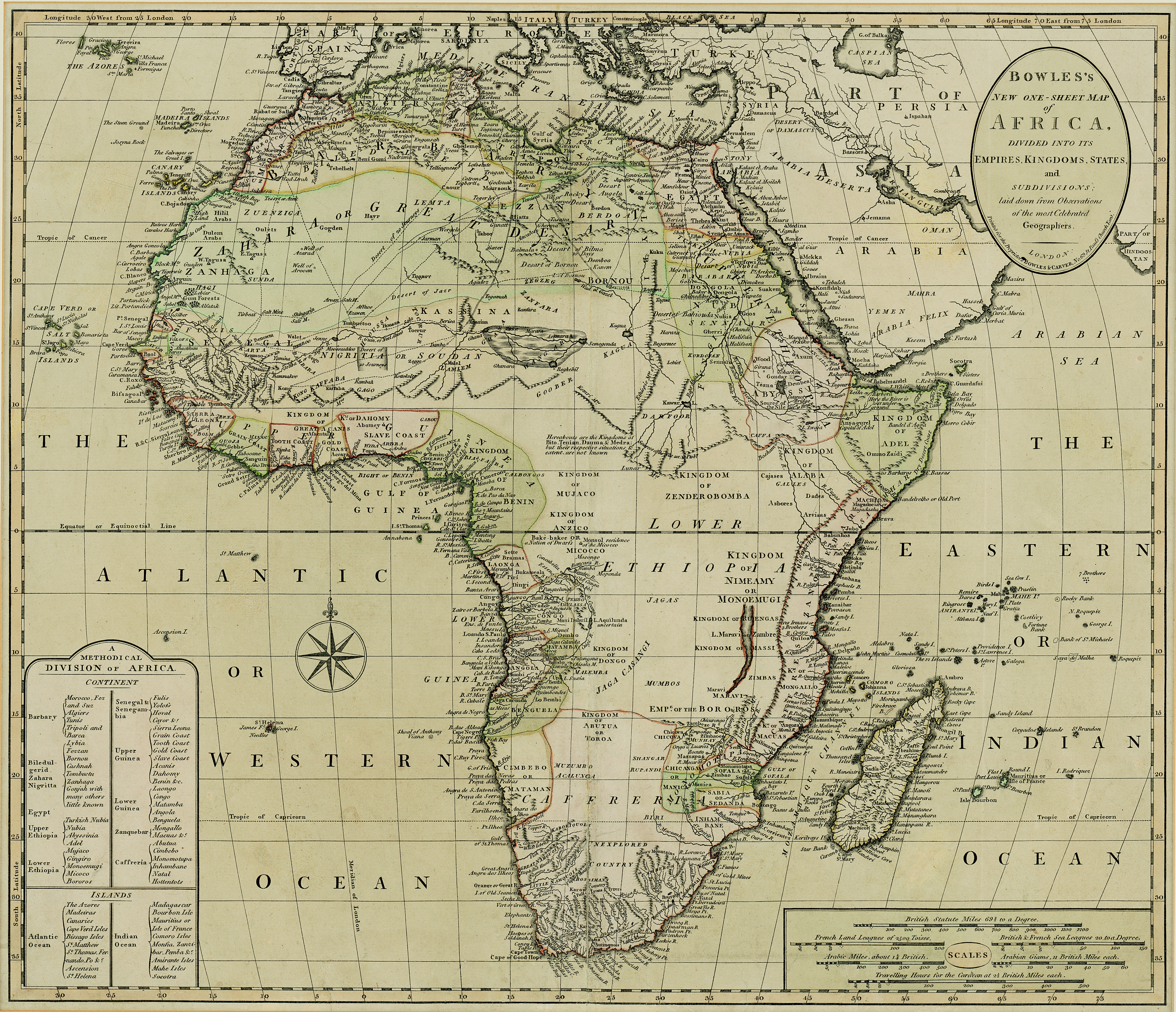
| dc.description.abstract | Coloured map.
Line scales given.
Inset: a Methodical division of Africa.
Carington Bowles was in partnership with his father John till the latter died in 1779; but from 1763 he took over his uncle Thomas Bowles' business in 69, St. Paul's Churchyard, & both this address & his father's are given on their maps. This map was probably pub. after his father's death in 1779 & before his own in 1793. | |
| dc.format.extent | 49 x 57cm | |
| dc.language.iso | en | |
| dc.publisher | Bowles & Carver | |
| dc.rights | This item is subject to copyright protection. Reproduction of the content, or any part of it, other than for research, academic or non-commercial use is prohibited without prior consent from the copyright holder. | |
| dc.source | Map from Hugh Solomon Collection, Africana. | |
| dc.subject | Africa -- Maps -- Early works to 1800 | en_ZA |
| dc.subject | Cartography -- Africa | en_ZA |
| dc.title | Bowles's new one-sheet map of Africa | en |
| dc.type | Map | |
| dc.rights.holder | Copyright Stellenbosch University | |