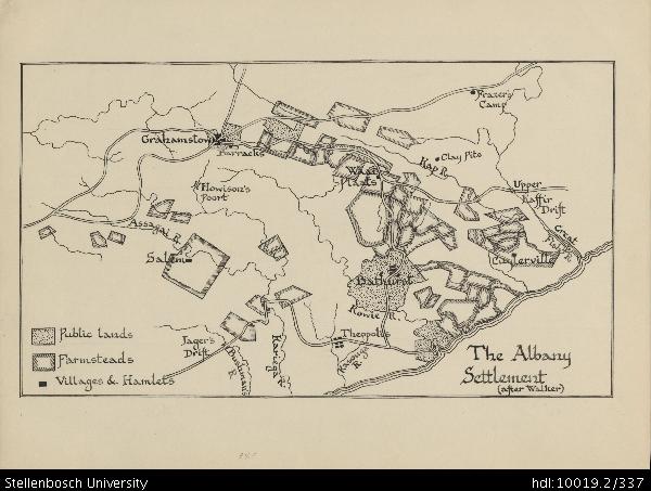
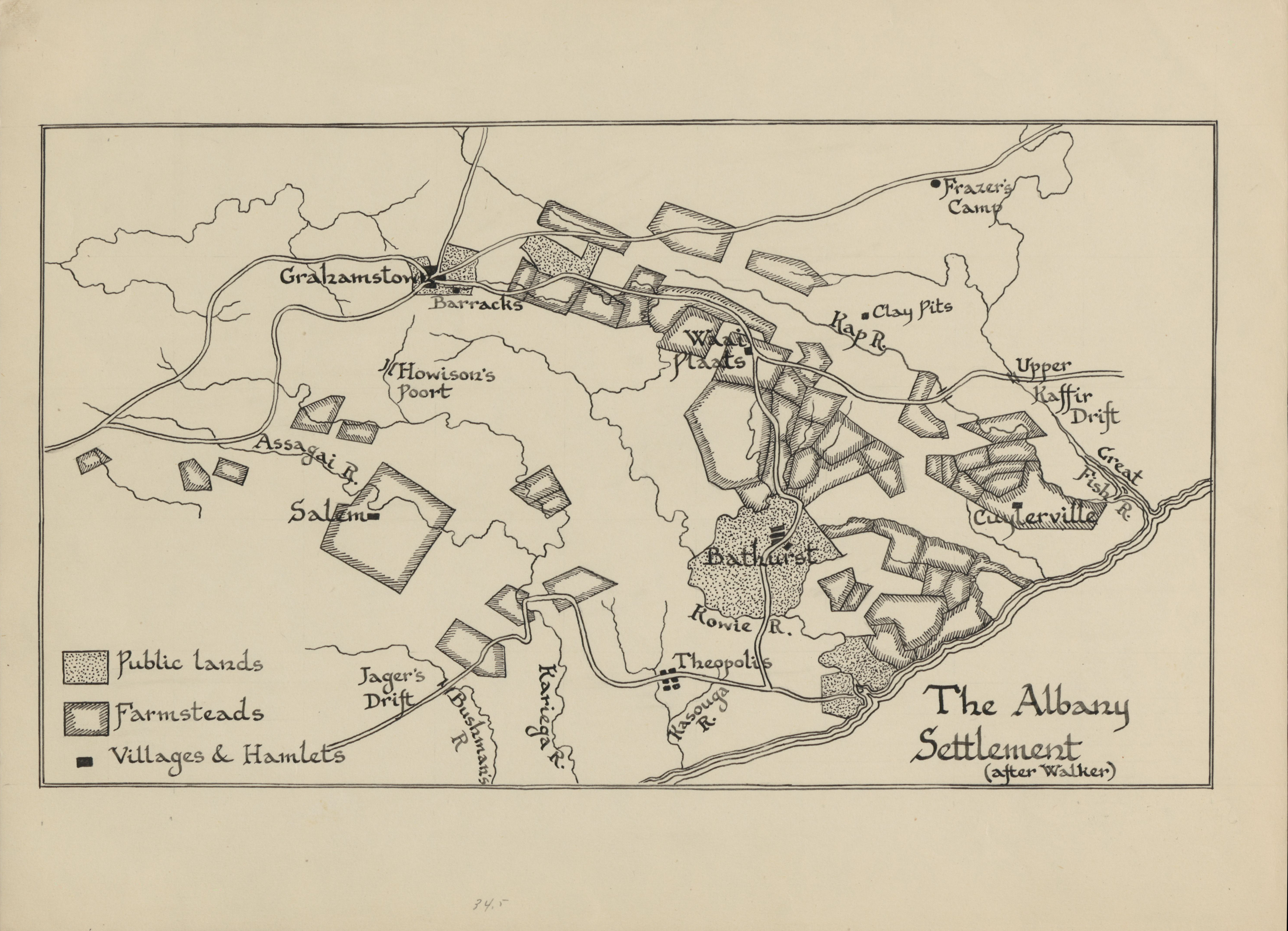
Map of the Albany Settlement
View/
Rights
This item is subject to copyright protection. Reproduction of the content, or any part of it, other than for research, academic or non-commercial use is prohibited without prior consent from the copyright holder.Copyright James Walton
Metadata
Show full item recordAbstract
Drawing of the Albany settlement, depicting detail of Jager's Drift, Bushman's River, Kariega River, Kasouga River, Theopolis, Kowie River, Bathurst, Cuylerville, Fish River, Great River, Upper Kaffir Drift, Kap River, Clay Pits, Frazer's Camp, Waai Plaats, Barracks, Grahamstown, Howison's Poort, Assagai River and Salem.
Collections
- James Walton Collection [885]