Ghoya settlement in the Orange Free State
View/
Rights
This item is subject to copyright protection. Reproduction of the content, or any part of it, other than for research, academic or non-commercial use is prohibited without prior consent from the copyright holder.Copyright James Walton
Metadata
Show full item recordAbstract
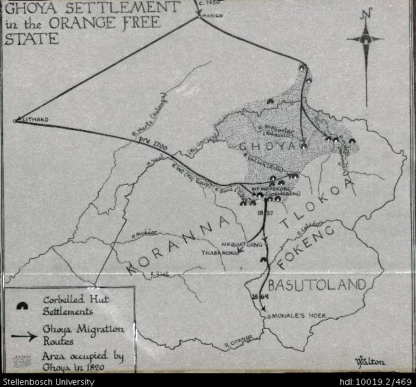
Drawing of a map of the Ghoya settlement in the Orange Free State, depicting the corbelled hut settlements, Ghoya migration routes and the area occupied by Ghoya in 1820. The map also depicts detail of Marico (c.1450), Lithako, the Hartz River (Kolouge), Kij Gariep, Rhenoster (Kokouatsi), Ghoya, the Wilge River (Namagari), the Valsch River (Enta), the Vaal River, the Vet River (Kij Goup), the Sand River Tikwe), Mount Mopororo (Doringberg), the Modder River, Koranna, the Riet River, Thaba Nchu, Mequatling, Tlokoa, the Orange River, the Caledon River, Fokeng, Basutoland and Mohale's Hoek.
Collections
- James Walton Collection [885]