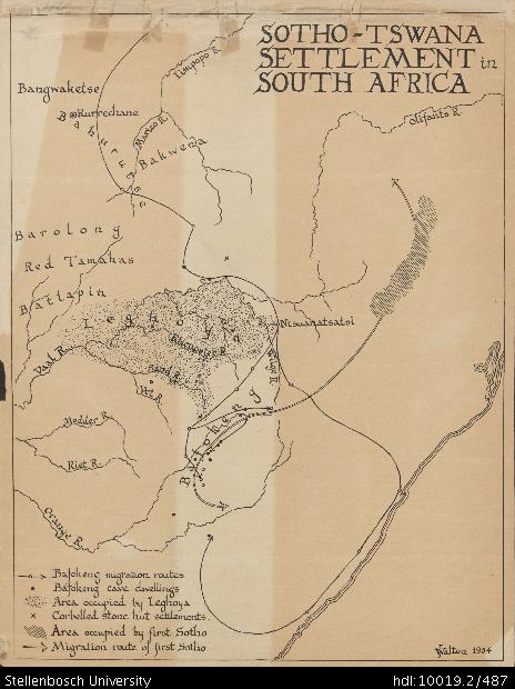
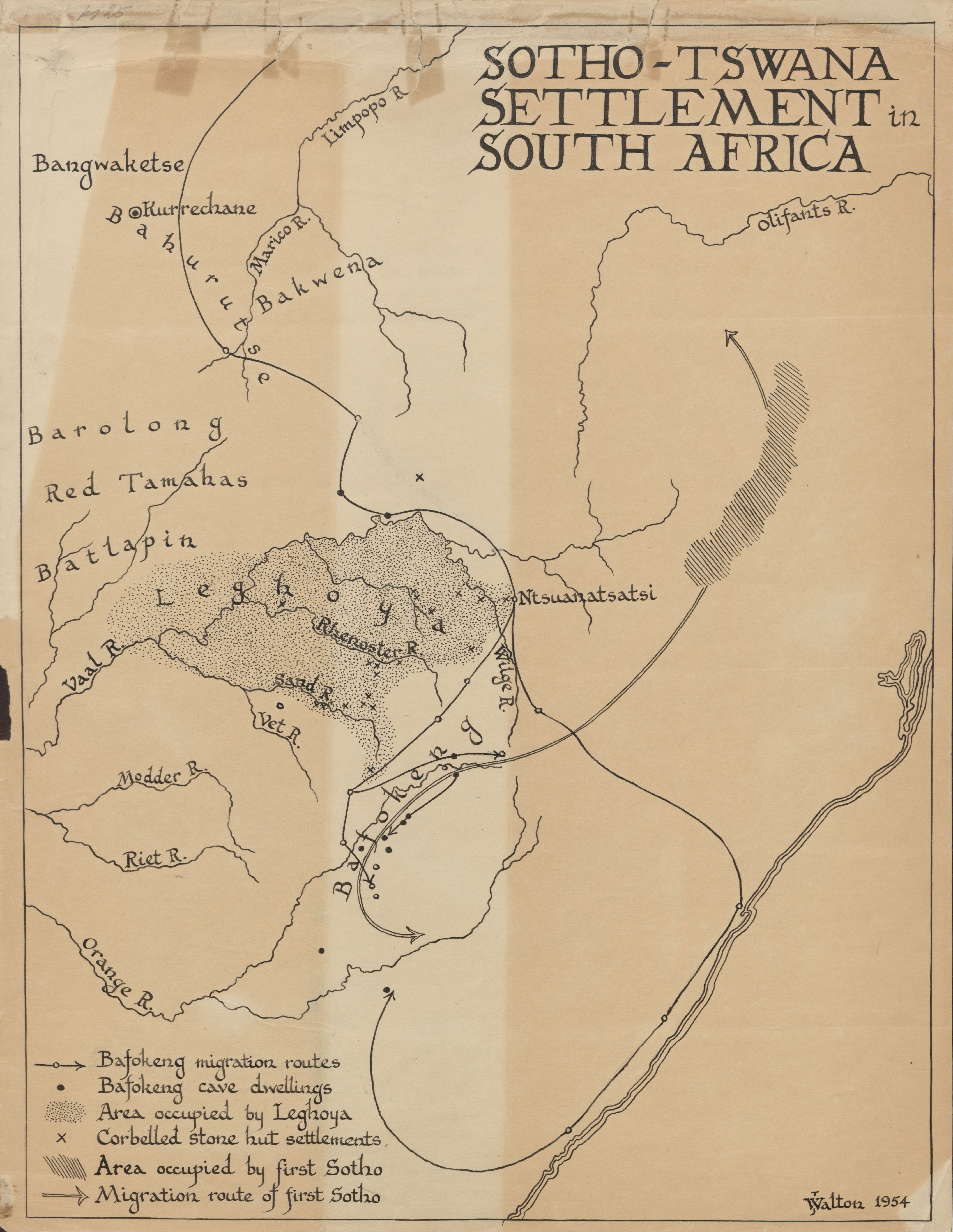
Sotho-Tswana settlement in South Africa
View/
Date Created
1954Rights
This item is subject to copyright protection. Reproduction of the content, or any part of it, other than for research, academic or non-commercial use is prohibited without prior consent from the copyright holder.Copyright James Walton
Metadata
Show full item recordAbstract
Drawing of a map of the Sotho-Tswana settlement in South Africa, depicting detail of the Limpopo River, Bangwaketse, Kurrechane, Bahurutse, Marico River, Bakwena, Barolong, Red Tamahas, Batlapin, the Vaal River, Leghoya, the Rhenoster River, the Sand River, the Vet River, the Modder River, the Riet River, the Orange River, Bafokeng, the Wilge River, Ntsuanatsatsi and the Olifants River. Detail are also provided of Bafokeng migration routes, Bafokeng cave dwellings, the area occupied by Leghoya, corbelled stone hut settlements, the area occupied by the first Sotho and the migration route of the first Sotho.
Collections
- James Walton Collection [885]