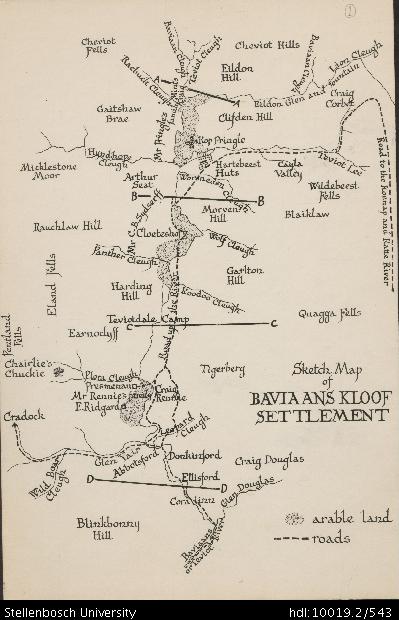
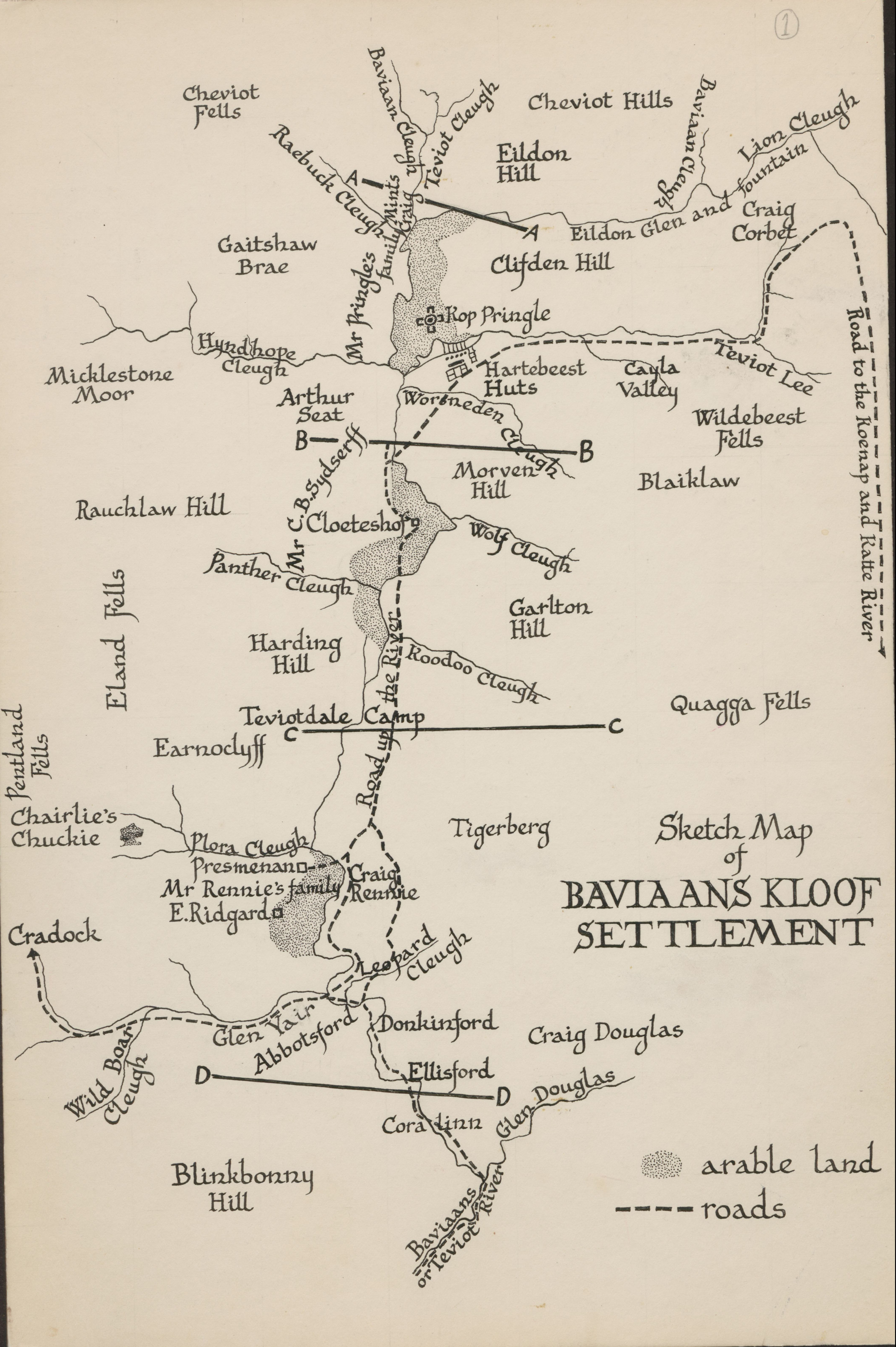
Sketch map of Baviaanskloof settlement
View/
Rights
This item is subject to copyright protection. Reproduction of the content, or any part of it, other than for research, academic or non-commercial use is prohibited without prior consent from the copyright holder.Copyright James Walton
Metadata
Show full item recordAbstract
Drawing of a map of Baviaanskloof settlement, depicting detail of Blinkbonny Hill, Baviaans or Teviot River, Cora Linn, Glen Douglas, Craig Douglas, Ellisford, Donkinford, Abbotsford, Glen Yair, Cleugh, Wild Boar, Leopard, Cradock, Craig Rennie, Mr. Rennie's family, E. Ridgard, Presmenan, Plora Cleugh, Tigerberg, Chairlie's Chuckie, Pentland Fells, Earnoclyff, Road up the river, Teviotdale Camp, Quagga Fells, Eland Fells, Harding Hill, Koodoo Cleugh, Panther Cleugh, Garlton Hill, Wolf Cleugh, Cloeteshof, Mr. C.B. Sydserff, Rauchlaw Hill, Morven Hill, Blaiklaw, Wildebeest Fells, Worsneden Cleugh, Arthur Seat, Micklestone Moor, Hyndhope Cleugh, Mr. Pringle's family, Hartebeest huts, Cayla Valley, Teviot Lee, Kop Pringle, Clifden Hill, Gaitshaw Brae, Raebuck Cleugh, Craig Mints, Cheviot Fells, Baviaan Cleugh, Teviot Cleugh, Cheviot Hills, Eildon Hill, Lion Cleugh, Eildon Glen and fountain, Craig Corbet and road to the Koenap and Kattle River. Details are also provided of arable lands and roads.
Collections
- James Walton Collection [885]