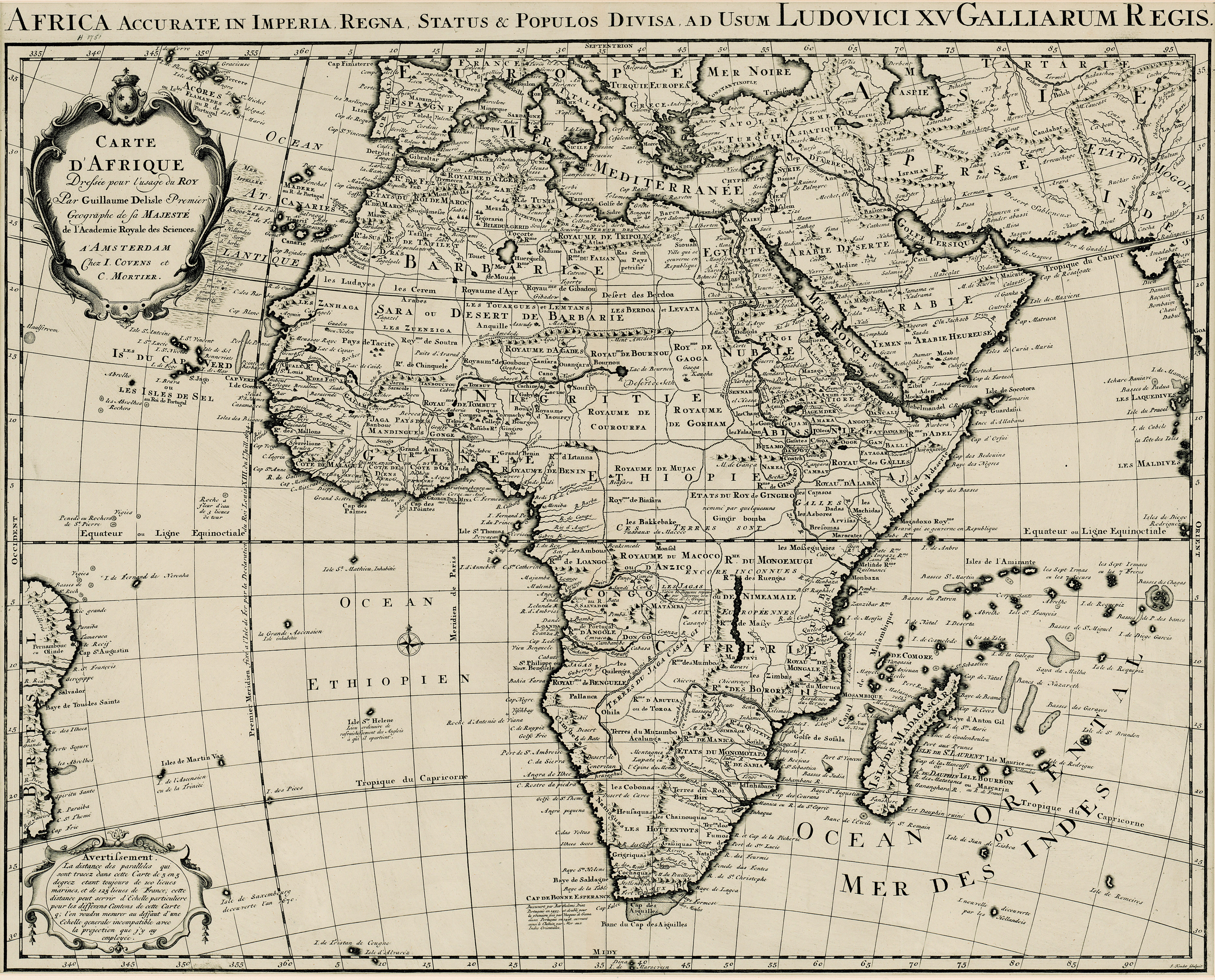
Carte d'Afrique
View/
Date Created
1730-1751Format Extent
49 x 62cmRights
This item is subject to copyright protection. Reproduction of the content, or any part of it, other than for research, academic or non-commercial use is prohibited without prior consent from the copyright holder.Copyright Stellenbosch University
Metadata
Show full item recordAbstract
Map.
Title above top of map: Africa accurate in imperia regna, status & populos divisa, ad usum Ludovici XV Galliarum regis.
In bottom right corner: J. Kondet Schulpsit. This a Dutch ed. of De l'Isle's revised map of 1722 with further additions. e.g. Hellenbok is corrected to Stellenbosch etc. According to Tooley in his "Collectors' guide to maps of Africa," 1969, p.71, the first issue of this map appeared after 1730. The date 1751 is given on a card attached to the map.