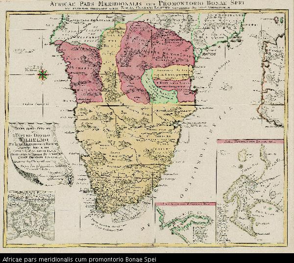
Africae pars meridionalis cum promontorio Bonae Spei
View/
Date Created
1778Format Extent
47 x 55cmRights
This item is subject to copyright protection. Reproduction of the content, or any part of it, other than for research, academic or non-commercial use is prohibited without prior consent from the copyright holder.Copyright Stellenbosch University
Metadata
Show full item recordAbstract
Coloured map.
Scale not given.
3 insets at foot of map: in left corner, "Castellum Batavorum in Promontorio Bonae Spei of het Casteel de Goede Hoop"; in right corner, "Sinus Saldanhae or Saldanha Bay", & "Ager Prbmontorii Bonae Spei."
"This map could be from "Atlas géographique de cent en huit cartes... par les Géographes Tobie Conrad Lotter pub. in 1678", Johannesburg Pub. Lib: Exhibition of decorative maps of Africa up to 1800, 1952, descriptive catalogue, p.139.