| dc.contributor | Ortelius, Abraham, 1527-1598 | |
| dc.coverage.spatial | Africa | |
| dc.coverage.temporal | 1590 | |
| dc.date.accessioned | 2012-10-11T10:19:48Z | |
| dc.date.available | 2012-10-11T10:19:48Z | |
| dc.date.created | 1590 | |
| dc.identifier.other | Map no. 47 | |
| dc.identifier.uri | http://hdl.handle.net/10019.2/819 | |
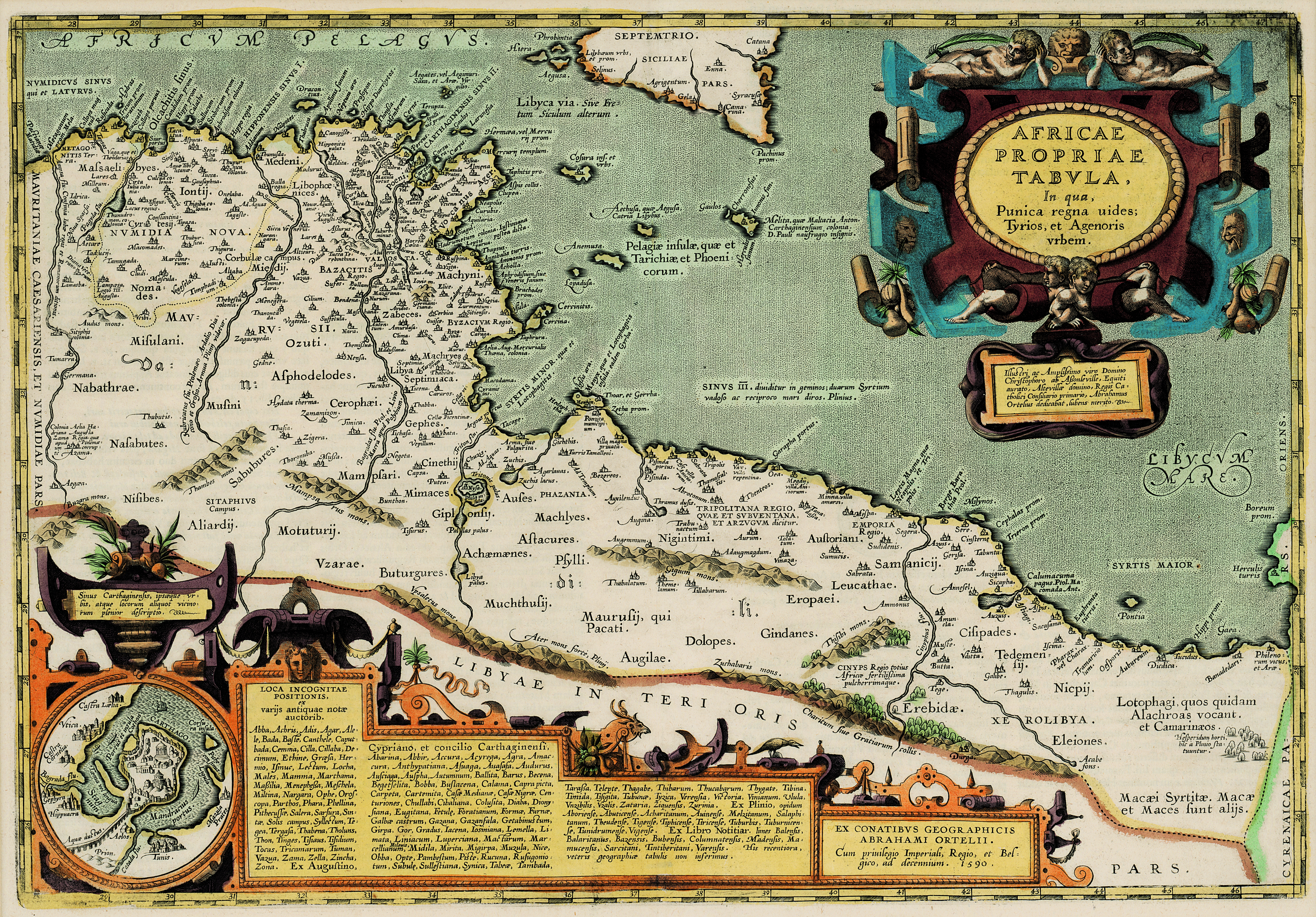
| dc.description.abstract | Coloured map.
Scale not given.
First appeared in theatrum orbis terrarum, Addimentum IV (parergon) of 1591.
At the bottom of the map in 2 decorated insets are a plan of Carthage and a list of sources.
Latin text on verso: Africa propria.
Appears in E. Klemp: Africa on maps dating from the 12th to the 18th century, 1968 (no.24). | |
| dc.format.extent | 33 x 48cm | |
| dc.language.iso | la | |
| dc.rights | This item is subject to copyright protection. Reproduction of the content, or any part of it, other than for research, academic or non-commercial use is prohibited without prior consent from the copyright holder. | |
| dc.source | Map from Hugh Solomon Collection, Africana. | |
| dc.subject | Africa -- Maps -- Early works to 1800 | en_ZA |
| dc.subject | Cartography -- Africa | en_ZA |
| dc.title | Africae propriae tabula | la |
| dc.type | Map | |
| dc.rights.holder | Copyright Stellenbosch University | |
| dc.description.featured | true | en_ZA |