• Login
    View Item 
    •   SUNDigital Collections
    • Images
    • Hugh Solomon Map Collection
    • View Item
    •   SUNDigital Collections
    • Images
    • Hugh Solomon Map Collection
    • View Item
    JavaScript is disabled for your browser. Some features of this site may not work without it.

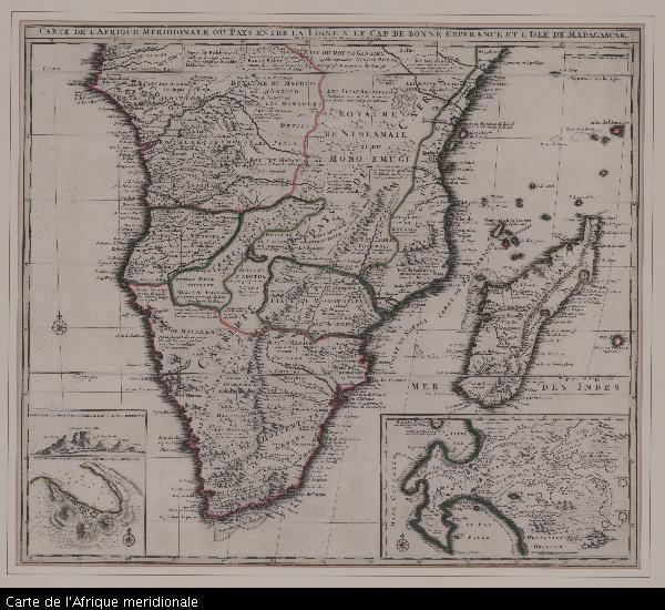
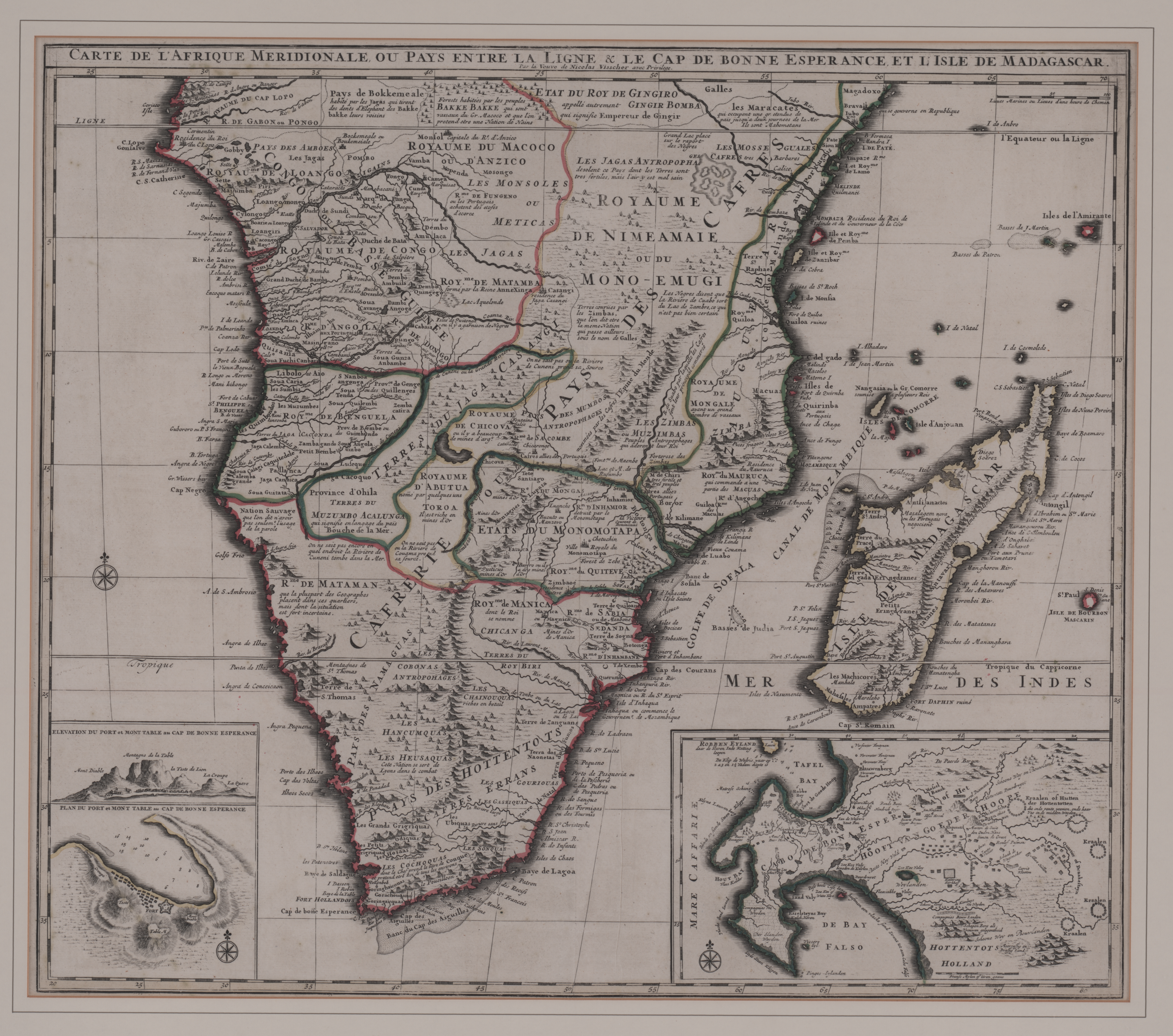
    Carte de l'Afrique meridionale

    Thumbnail
    View/Open
    map-67.jpg (26.42Mb)
    Date
    1710
    Author
    Visscher, Nicolaes, 1649-1702, widow of
    Date Created
    1710
    Format Extent
    51 x 58cm
    Rights
    This item is subject to copyright protection. Reproduction of the content, or any part of it, other than for research, academic or non-commercial use is prohibited without prior consent from the copyright holder.
    Copyright Stellenbosch University
    Metadata
    Show full item record
    Abstract
    Coloured map. Line scale given. 3 insets: 1, "Elevation du port et Mont Table au Cap de Bonne Esperance." - 2, "Plan du port et Mont Table au Cap de Bonne Esperance." - 3, in the right hand lower corner is an enlarged map of the Cape and its vicinity, but without a caption. This gives detailed information about the various settlements including the names of farmers. First appeared in F. de Wit: Atlas major, Amsterdam, c.1705; was later pub. by the widow Visscher in "Atlas minor..." in c.1717. Appears in E. Klemp: Africa on maps dating from the 12th to the 18th century, 1968 (no.67), fully col.
    URI
    http://hdl.handle.net/10019.2/831
    Collections
    • Hugh Solomon Map Collection [97]

    DSpace software copyright © 2002-2016  DuraSpace
    Contact Us
    Theme by 
    Atmire NV


    Browse

    All of SUNDigital CollectionsCommunities & CollectionsBy Issue DateAuthorsTitlesSubjectsBy Date CreatedThis CollectionBy Issue DateAuthorsTitlesSubjectsBy Date Created

    My Account

    LoginRegister

    Statistics

    View Usage Statistics

    DSpace software copyright © 2002-2016  DuraSpace
    Contact Us
    Theme by 
    Atmire NV