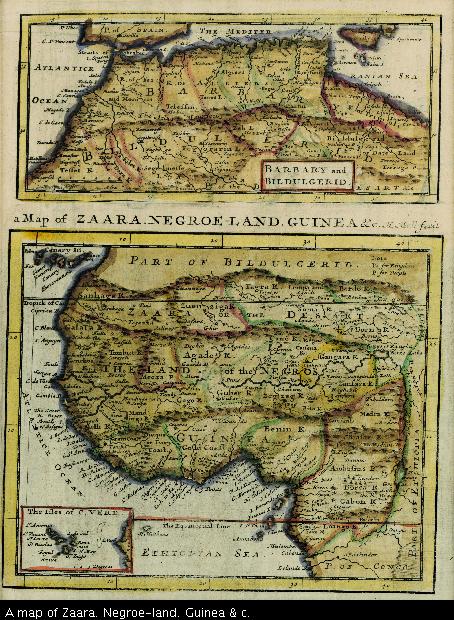
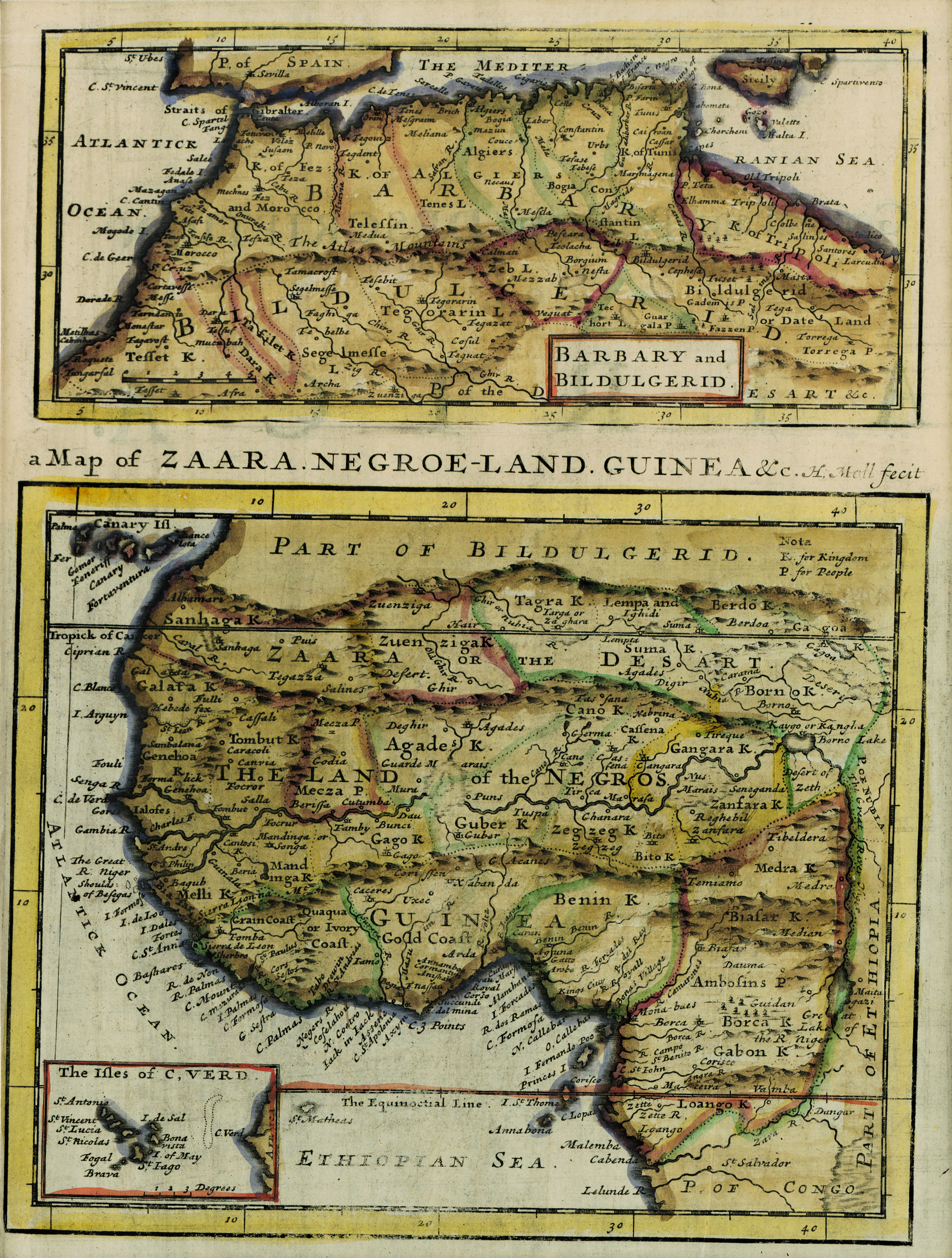
A map of Zaara. Negroe-land. Guinea & c.
View/
Date Created
1701Format Extent
16 x 19cmRights
This item is subject to copyright protection. Reproduction of the content, or any part of it, other than for research, academic or non-commercial use is prohibited without prior consent from the copyright holder.Copyright Stellenbosch University
Metadata
Show full item recordAbstract
Coloured map on sheet.
Lower half of a sheet with "Barbary and Bildurgerid"; on verso, "Africa."
Page number top left, 134, headed "Africa".
Inset: The Isles of C. Verd.
This sheet of maps (uncoloured) appears in H. Moll's "A system of geography..." pub. London, T. Childe, 1701, part 2 p.99-100.