• Login
    View Item 
    •   SUNDigital Collections
    • Images
    • Hugh Solomon Map Collection
    • View Item
    •   SUNDigital Collections
    • Images
    • Hugh Solomon Map Collection
    • View Item
    JavaScript is disabled for your browser. Some features of this site may not work without it.

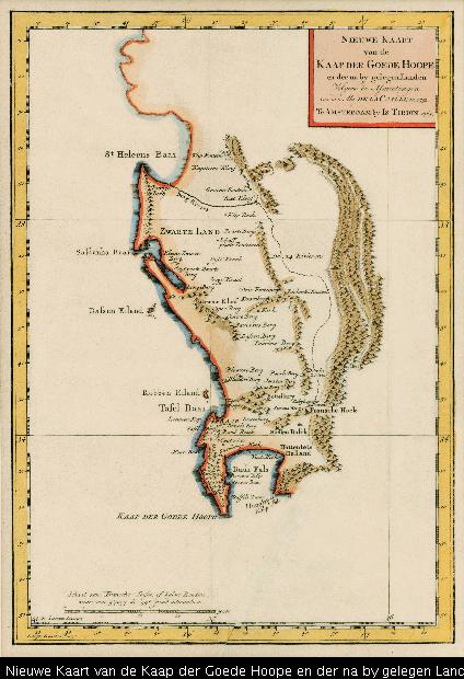
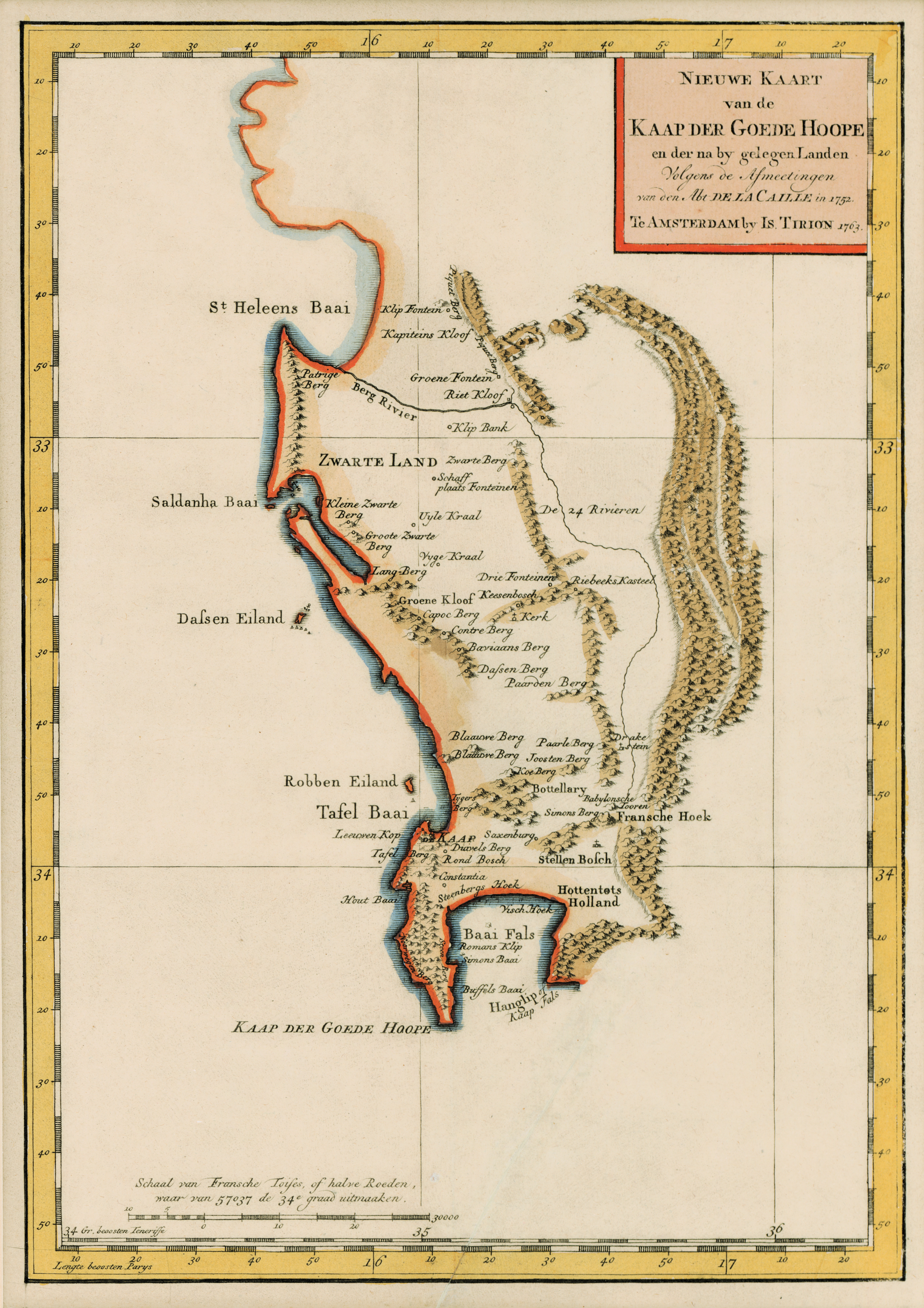
    Nieuwe Kaart van de Kaap der Goede Hoope en der na by gelegen Landen

    Thumbnail
    View/Open
    map-91.jpg (27.10Mb)
    Date
    1763
    Author
    Tirion, Isaak, d.1769?
    Date Created
    1763
    Format Extent
    31 x 22cm
    Rights
    This item is subject to copyright protection. Reproduction of the content, or any part of it, other than for research, academic or non-commercial use is prohibited without prior consent from the copyright holder.
    Copyright Stellenbosch University
    Metadata
    Show full item record
    Abstract
    Coloured map. Line scale given in bottom left corner in "Fransche Toises, of halve Roeden." This map (uncoloured) appears in "Hedendaagsche historie of tegenwoordige staat van Afrika", pub. Amsterdam, I. Tirion, 1763, p.683.
    URI
    http://hdl.handle.net/10019.2/843
    Collections
    • Hugh Solomon Map Collection [97]

    DSpace software copyright © 2002-2016  DuraSpace
    Contact Us
    Theme by 
    Atmire NV


    Browse

    All of SUNDigital CollectionsCommunities & CollectionsBy Issue DateAuthorsTitlesSubjectsBy Date CreatedThis CollectionBy Issue DateAuthorsTitlesSubjectsBy Date Created

    My Account

    LoginRegister

    Statistics

    View Usage Statistics

    DSpace software copyright © 2002-2016  DuraSpace
    Contact Us
    Theme by 
    Atmire NV