| dc.contributor | Ortelius, Abraham, 1527-1598 | |
| dc.coverage.temporal | 1598 | |
| dc.date.accessioned | 2012-10-11T10:19:49Z | |
| dc.date.available | 2012-10-11T10:19:49Z | |
| dc.date.created | 1598 | |
| dc.identifier.other | Map no. 98 | |
| dc.identifier.uri | http://hdl.handle.net/10019.2/848 | |
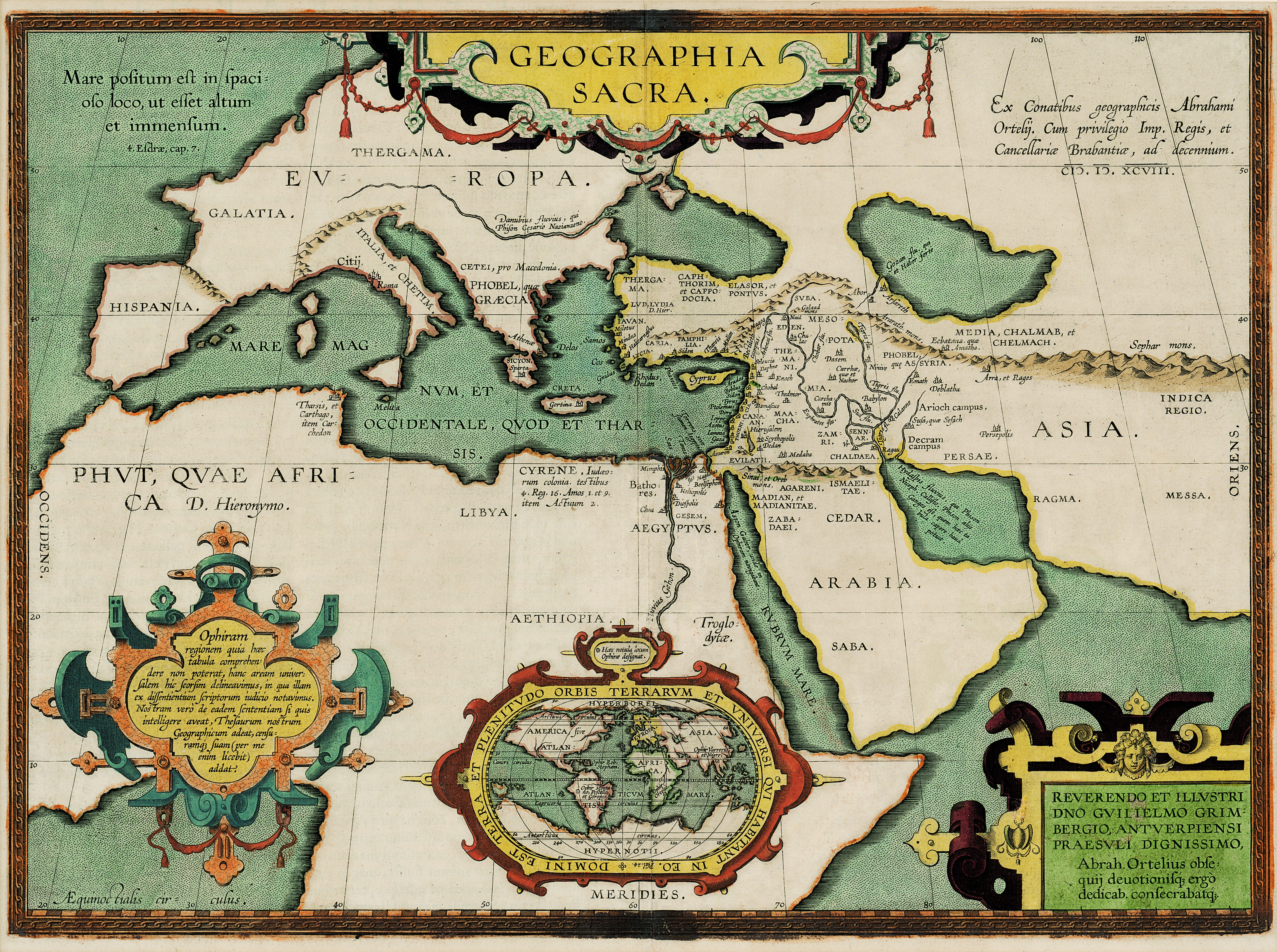
| dc.description.abstract | Coloured map.
[Scale not given]
3 decorated insets:- 1, Giving authorities.- 2, Map of the world.- 3, In bottom right corner: Reverendo et illustridno Gulielmo Grimbergio, Antverpiensi praesuli dignissimo...
This map first appeared in A. Ortelius: Theatrum orbis terrarum, parergon, of 1603, but the possibility of it being pub. is mentioned in a letter of Ortelius dated 21 Sept. 1596. (See E. Brandmair: Bibliogr. Untersuchungen... des Ortelianischen Kartenwerkes).
Latin text on verso: Geographia sacra. | |
| dc.format.extent | 35 x 48cm | |
| dc.language.iso | la | |
| dc.rights | This item is subject to copyright protection. Reproduction of the content, or any part of it, other than for research, academic or non-commercial use is prohibited without prior consent from the copyright holder. | |
| dc.source | Map from Hugh Solomon Collection, Africana. | |
| dc.subject | World maps -- Early works to 1800 | en_ZA |
| dc.title | Geographia sacra | la |
| dc.type | Map | |
| dc.rights.holder | Copyright Stellenbosch University | |