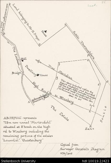
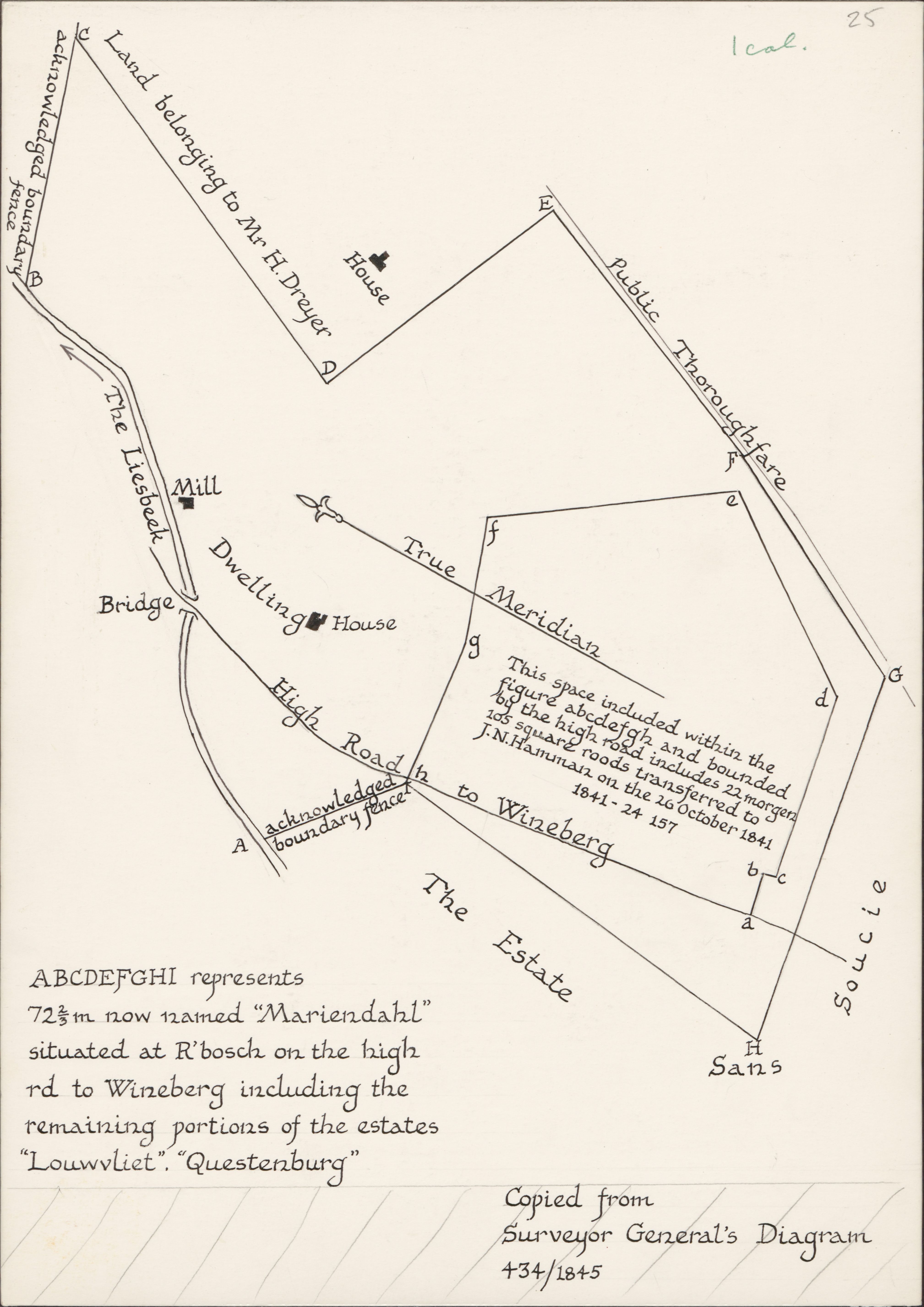
Plan of Dreyer's Mill on Louwvliet
View/
Rights
This item is subject to copyright protection. Reproduction of the content, or any part of it, other than for research, academic or non-commercial use is prohibited without prior consent from the copyright holder.Copyright James Walton
Metadata
Show full item recordAbstract
Drawing of a plan copied from the Surveyor General's diagram 434/1845, depicting detail of the estate, 2 acknowledged boundary fences, a bridge, the Liesbeek River, land belonging to Mr H. Dreyer, a house, a public thoroughfare, Sans Soucie, the high road to Wynberg, a dwelling house, the mill, a true meridian and a space (abcdefghi) which represents 72⅔m now named "Mariendahl" situated at Rondebosch on the high road to Wynberg including the remaining portions of the estates "Louwvliet", "Questenburg".
Collections
- James Walton Collection [885]