| dc.contributor.illustrator | Walton, James, 1911-1999 | |
| dc.coverage.spatial | Newlands, Cape Town | |
| dc.date.accessioned | 2012-10-02T09:06:21Z | |
| dc.date.available | 2012-10-02T09:06:21Z | |
| dc.identifier.other | 247.A.1.C.5.1(12) | |
| dc.identifier.uri | http://hdl.handle.net/10019.2/423 | |
| dc.description | 247.A.1.C.5.1(12).jpg derived from archival TIFF file. Digital copies were created from a selection of drawings in the original James Walton manuscript collection (MS 247) held in the Manuscripts Section of the Stellenbosch Library and Information Service Collection. | en_ZA |
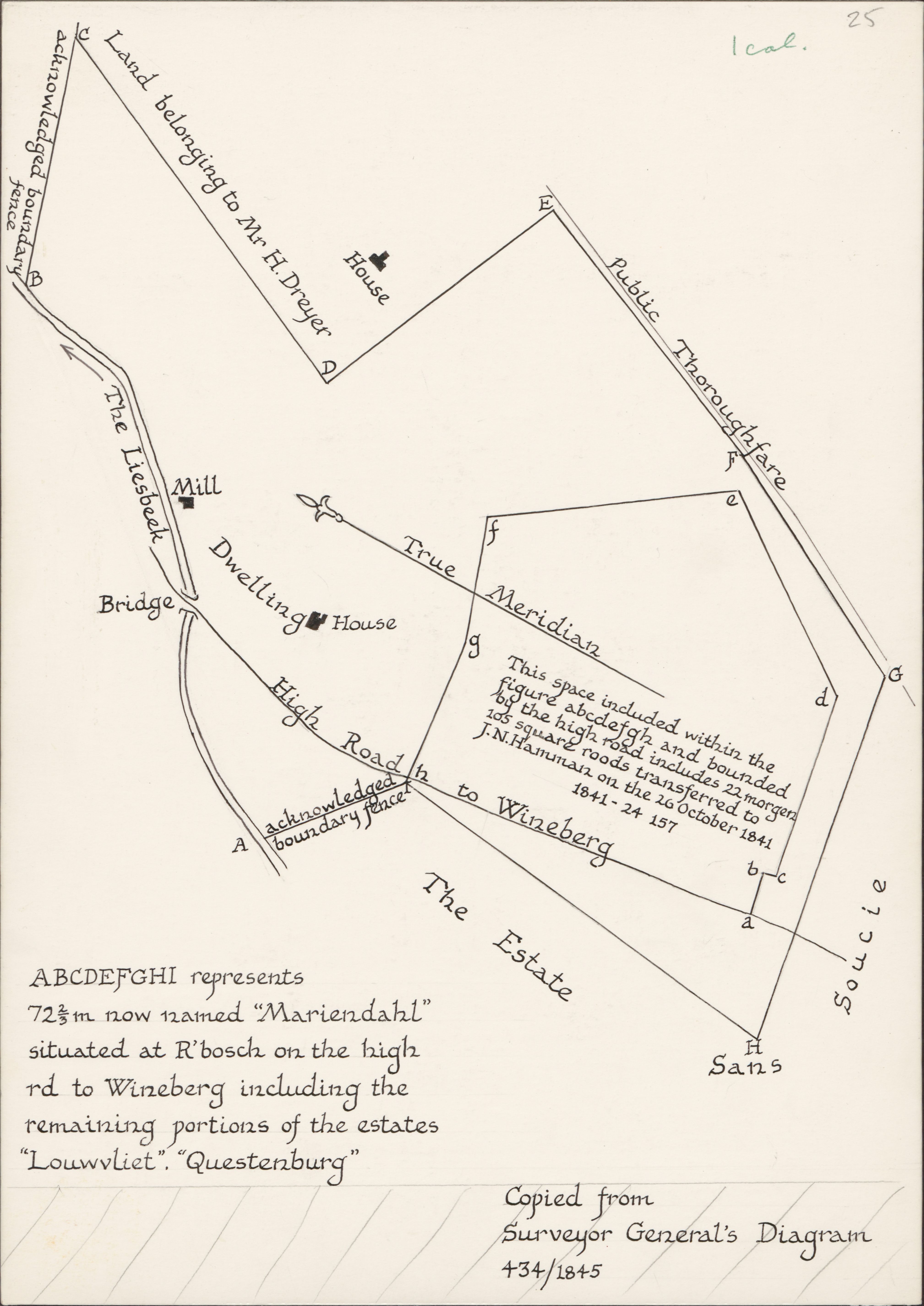
| dc.description | This illustration was published in The Josephine Mill and its owners : the story of milling and brewing at the Cape of Good Hope edited by James Walton. Cape Town : Historical Society of Cape Town, 1978, p.15. | |
| dc.description.abstract | Drawing of a plan copied from the Surveyor General's diagram 434/1845, depicting detail of the estate, 2 acknowledged boundary fences, a bridge, the Liesbeek River, land belonging to Mr H. Dreyer, a house, a public thoroughfare, Sans Soucie, the high road to Wynberg, a dwelling house, the mill, a true meridian and a space (abcdefghi) which represents 72⅔m now named "Mariendahl" situated at Rondebosch on the high road to Wynberg including the remaining portions of the estates "Louwvliet", "Questenburg". | |
| dc.format.medium | Ink on paper | |
| dc.language.iso | en | |
| dc.rights | This item is subject to copyright protection. Reproduction of the content, or any part of it, other than for research, academic or non-commercial use is prohibited without prior consent from the copyright holder. | |
| dc.subject | Cape of Good Hope (South Africa) -- Maps | en_ZA |
| dc.subject | Water mills -- South Africa -- Cape of Good Hope | en_ZA |
| dc.subject | Water mills -- History | en_ZA |
| dc.subject | Walton, James, 1911-1999 -- Drawings | en_ZA |
| dc.title | Plan of Dreyer's Mill on Louwvliet | en_ZA |
| dc.type | Image | en_ZA |
| dc.rights.holder | Copyright James Walton | |