| dc.contributor | Seller, John | |
| dc.coverage.spatial | Cape of Good Hope | |
| dc.coverage.temporal | 1675 | |
| dc.date.accessioned | 2012-10-11T10:19:46Z | |
| dc.date.available | 2012-10-11T10:19:46Z | |
| dc.date.created | 1675 | |
| dc.identifier.other | Map no. 88 | |
| dc.identifier.uri | http://hdl.handle.net/10019.2/780 | |
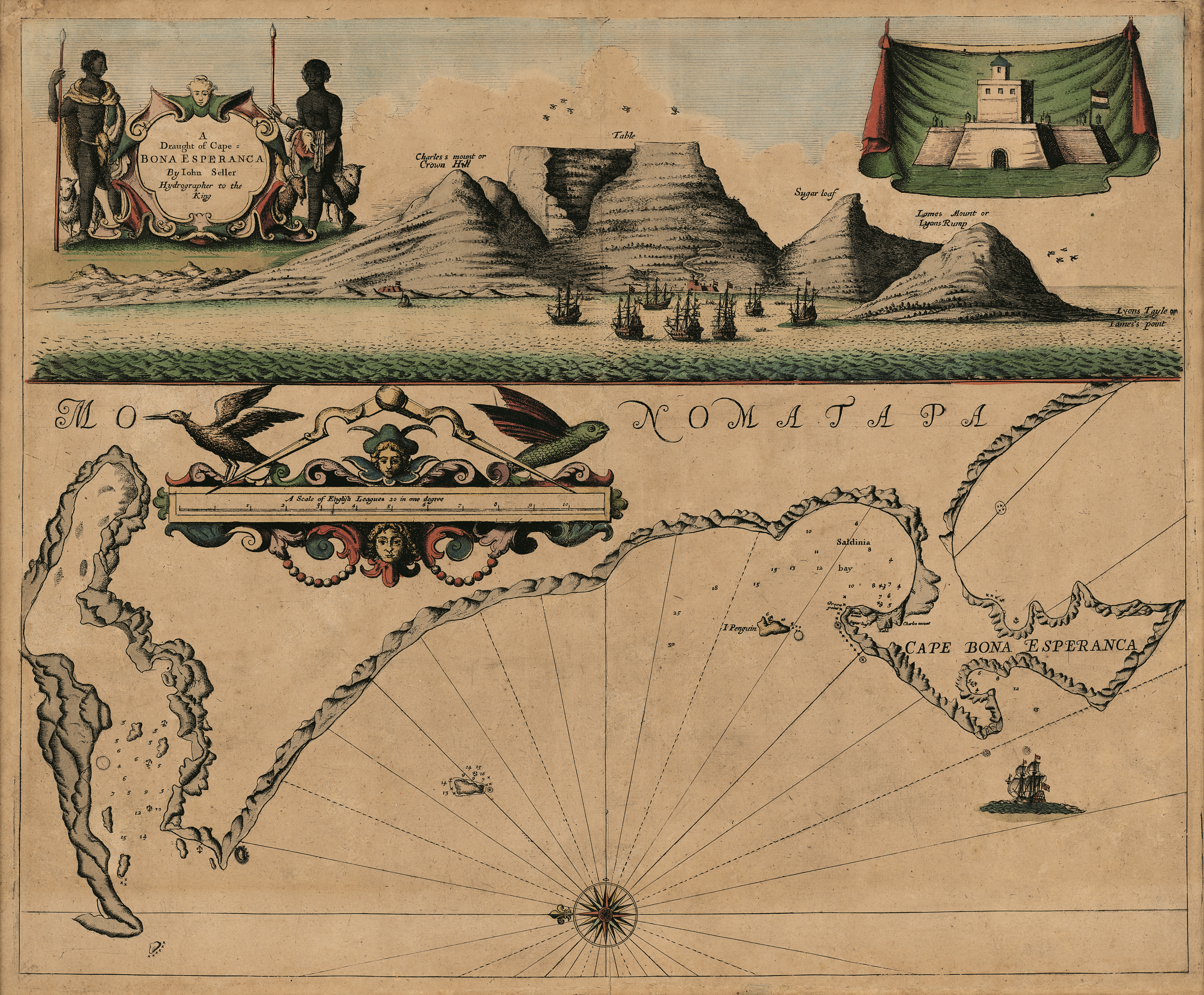
| dc.description.abstract | Coloured chart.
Line scale given.
Title within decorated cartouche is in top left corner & in top right is an inset of a fort; running across the top of the map is a view of Table Bay. Map has a large decorative scale in English leagues.
First appeared in J. Seller: Third book of the English Pilot, 1675. | |
| dc.format.extent | 45 x 54cm | |
| dc.language.iso | en | |
| dc.rights | This item is subject to copyright protection. Reproduction of the content, or any part of it, other than for research, academic or non-commercial use is prohibited without prior consent from the copyright holder. | |
| dc.source | Map from Hugh Solomon Collection, Africana. | |
| dc.subject | Cape of Good Hope (South Africa) -- Maps | en_ZA |
| dc.subject | South Africa -- Maps -- Early works to 1800 | en_ZA |
| dc.subject | Cartography -- South Africa -- Cape of Good Hope | en_ZA |
| dc.title | A draught of Cape Bona Esperanca | en |
| dc.type | Map | |
| dc.rights.holder | Copyright Stellenbosch University | |