| dc.coverage.spatial | Africa | |
| dc.coverage.temporal | 17-- | |
| dc.date.accessioned | 2012-10-11T10:19:46Z | |
| dc.date.available | 2012-10-11T10:19:46Z | |
| dc.date.created | 17-- | |
| dc.identifier.other | Map no. 2 | |
| dc.identifier.uri | http://hdl.handle.net/10019.2/782 | |
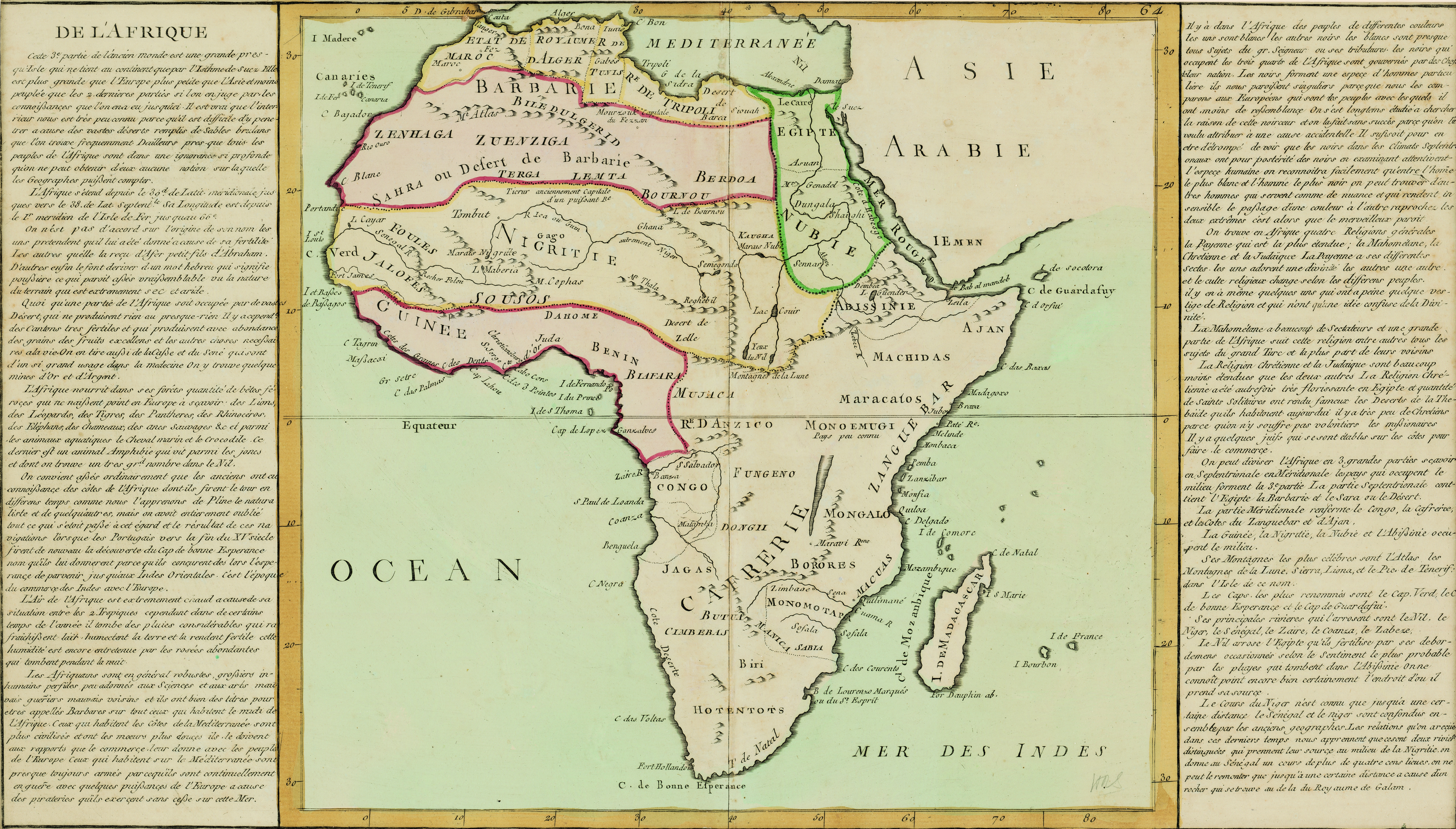
| dc.description.abstract | Coloured map.
Scale not given.
On either side of map is a description of Africa in French which is headed "De l'Afrique.” A plain map with no decoration, no title or indication of its author or source. In southern Africa only the following are noted: Fort Hollandois, C. de Bonne Esperance, T. de Natal. | |
| dc.format.extent | 31 x 34cm | |
| dc.language.iso | fr | |
| dc.rights | This item is subject to copyright protection. Reproduction of the content, or any part of it, other than for research, academic or non-commercial use is prohibited without prior consent from the copyright holder. | |
| dc.source | Map from Hugh Solomon Collection, Africana. | |
| dc.subject | Africa -- Maps -- Early works to 1800 | en_ZA |
| dc.subject | Cartography -- Africa | en_ZA |
| dc.title | De l'Afrique | fr |
| dc.type | Map | |
| dc.rights.holder | Copyright Stellenbosch University | |