• Login
    View Item 
    •   SUNDigital Collections
    • Images
    • Hugh Solomon Map Collection
    • View Item
    •   SUNDigital Collections
    • Images
    • Hugh Solomon Map Collection
    • View Item
    JavaScript is disabled for your browser. Some features of this site may not work without it.

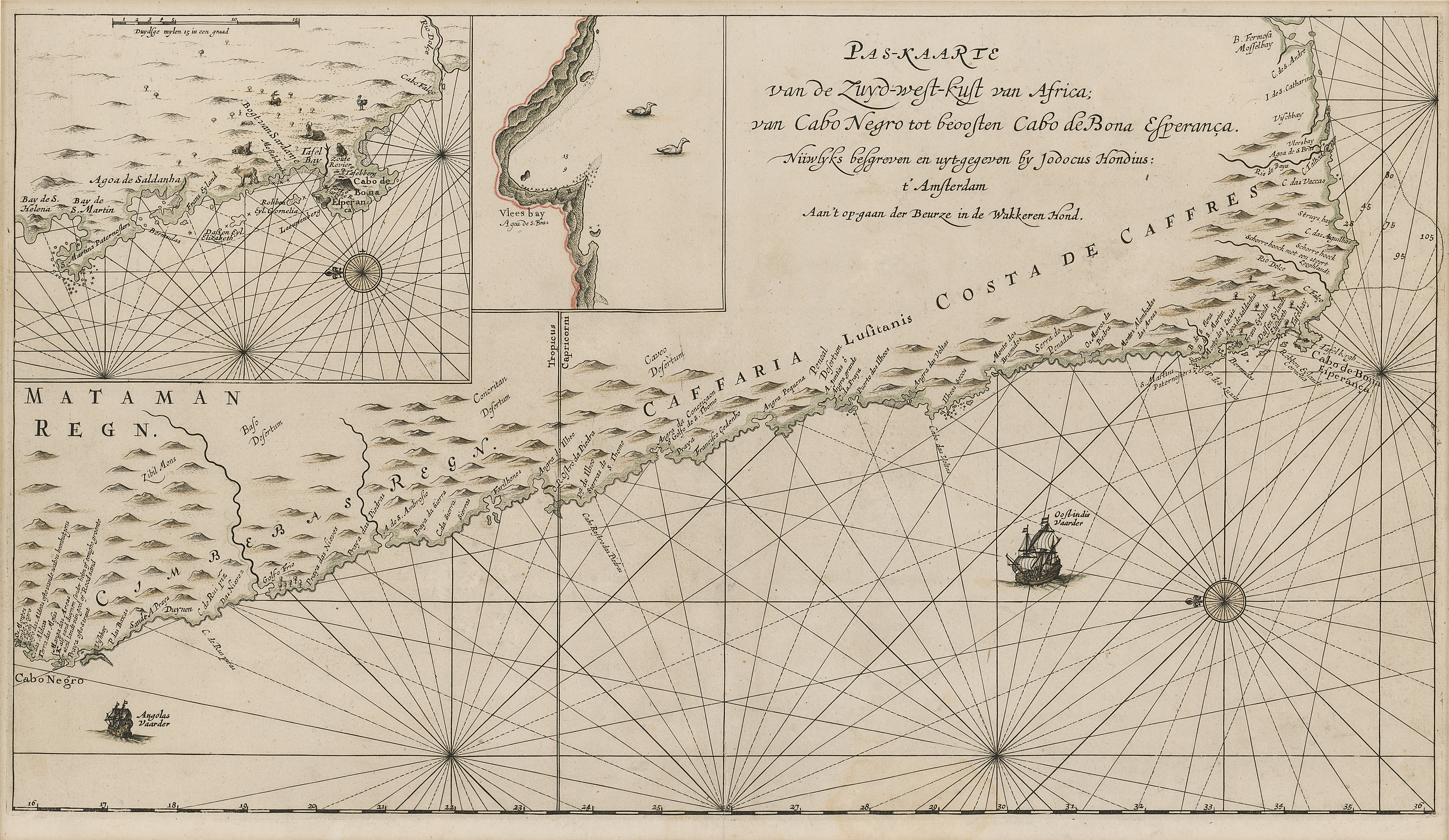
    Paskaart van de Zuyd-west-kust van Africa

    Thumbnail
    View/Open
    map-84.jpg (19.08Mb)
    Date
    1652
    Author
    Hondius, Jodocus (III), fl. 1652
    Date Created
    1652
    Format Extent
    30 x 53cm
    Rights
    This item is subject to copyright protection. Reproduction of the content, or any part of it, other than for research, academic or non-commercial use is prohibited without prior consent from the copyright holder.
    Copyright Stellenbosch University
    Metadata
    Show full item record
    Abstract
    Coloured chart. Line scale given for inset. Inset in top left corner has no title but is an enlarged chart of the coast between St. Helena & False Bay. Smaller inset next to it, is an enlargement of Vlees (Mossel) Bay. This map appears in J. Hondius: Klare besgryving van Cabo de Bona Esperanca, 1652 but has 4 columns of descriptive matter below the map.
    URI
    http://hdl.handle.net/10019.2/793
    Collections
    • Hugh Solomon Map Collection [97]

    DSpace software copyright © 2002-2016  DuraSpace
    Contact Us
    Theme by 
    Atmire NV


    Browse

    All of SUNDigital CollectionsCommunities & CollectionsBy Issue DateAuthorsTitlesSubjectsBy Date CreatedThis CollectionBy Issue DateAuthorsTitlesSubjectsBy Date Created

    My Account

    LoginRegister

    Statistics

    View Usage Statistics

    DSpace software copyright © 2002-2016  DuraSpace
    Contact Us
    Theme by 
    Atmire NV