| dc.contributor | Hondius, Jodocus (III), fl. 1652 | |
| dc.coverage.spatial | Africa | |
| dc.coverage.temporal | 1652 | |
| dc.date.accessioned | 2012-10-11T10:19:47Z | |
| dc.date.available | 2012-10-11T10:19:47Z | |
| dc.date.created | 1652 | |
| dc.date.issued | 1652 | |
| dc.identifier.other | Map no. 84 | |
| dc.identifier.uri | http://hdl.handle.net/10019.2/793 | |
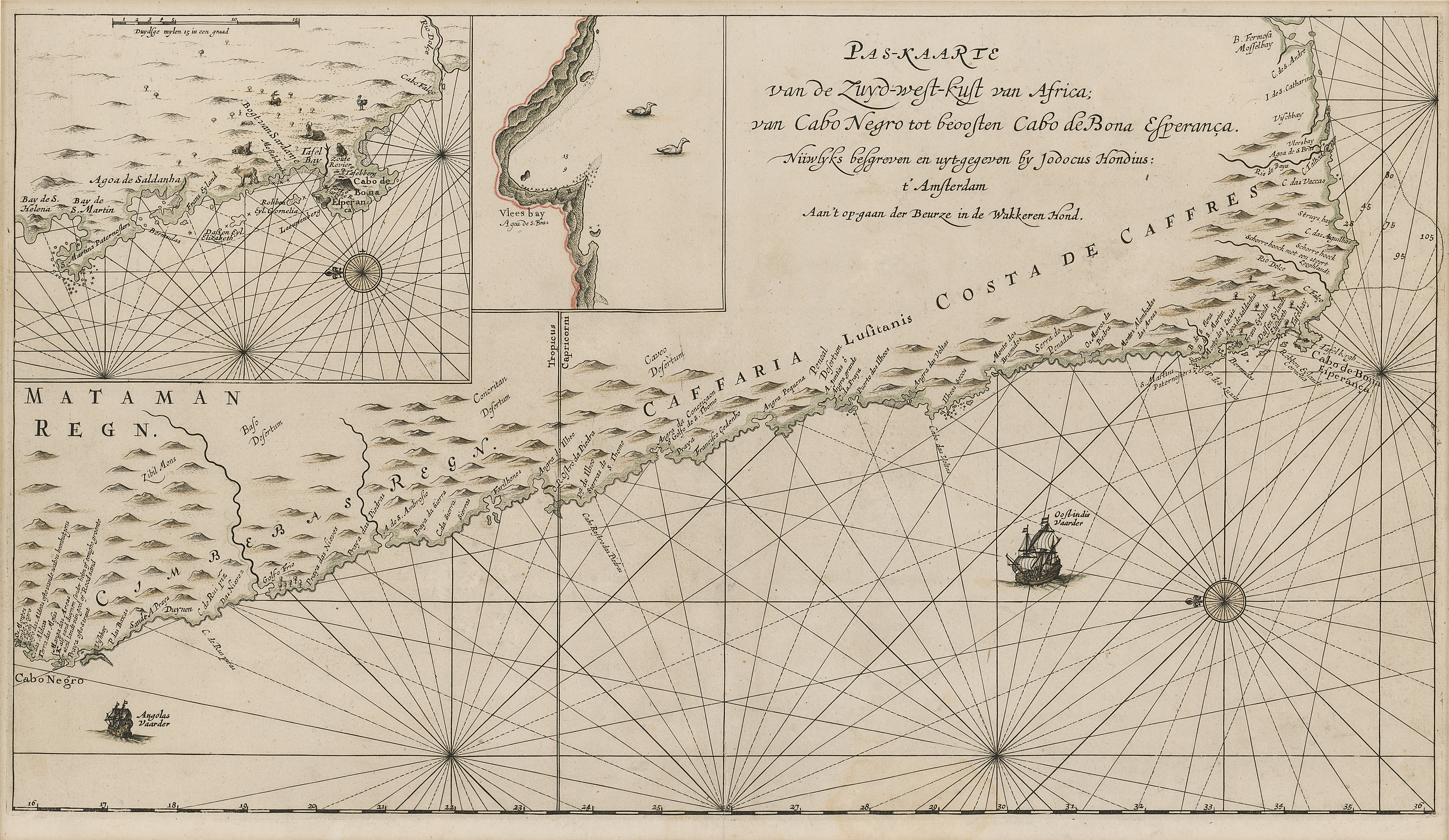
| dc.description.abstract | Coloured chart.
Line scale given for inset.
Inset in top left corner has no title but is an enlarged chart of the coast between St. Helena & False Bay. Smaller inset next to it, is an enlargement of Vlees (Mossel) Bay.
This map appears in J. Hondius: Klare besgryving van Cabo de Bona Esperanca, 1652 but has 4 columns of descriptive matter below the map. | |
| dc.format.extent | 30 x 53cm | |
| dc.language.iso | nl | |
| dc.publisher | Jodocus Hondius | |
| dc.rights | This item is subject to copyright protection. Reproduction of the content, or any part of it, other than for research, academic or non-commercial use is prohibited without prior consent from the copyright holder. | |
| dc.source | Map from Hugh Solomon Collection, Africana. | |
| dc.subject | Africa -- Maps -- Early works to 1800 | en_ZA |
| dc.subject | Cartography -- Africa | en_ZA |
| dc.title | Paskaart van de Zuyd-west-kust van Africa | nl |
| dc.type | Map | |
| dc.rights.holder | Copyright Stellenbosch University | |