| dc.contributor.illustrator | Walton, James, 1911-1999 | |
| dc.coverage.spatial | Cape of Good Hope | |
| dc.date.accessioned | 2012-09-20T06:58:42Z | |
| dc.date.available | 2012-09-20T06:58:42Z | |
| dc.identifier.other | 247.A.1.A.5.1(2) | |
| dc.identifier.uri | http://hdl.handle.net/10019.2/314 | |
| dc.description | 247.A.1.A.5.1(2).jpg derived from archival TIFF file. Digital copies were created from a selection of drawings in the original James Walton manuscript collection (MS 247) held in the Manuscripts Section of the Stellenbosch Library and Information Service Collection. | en_ZA |
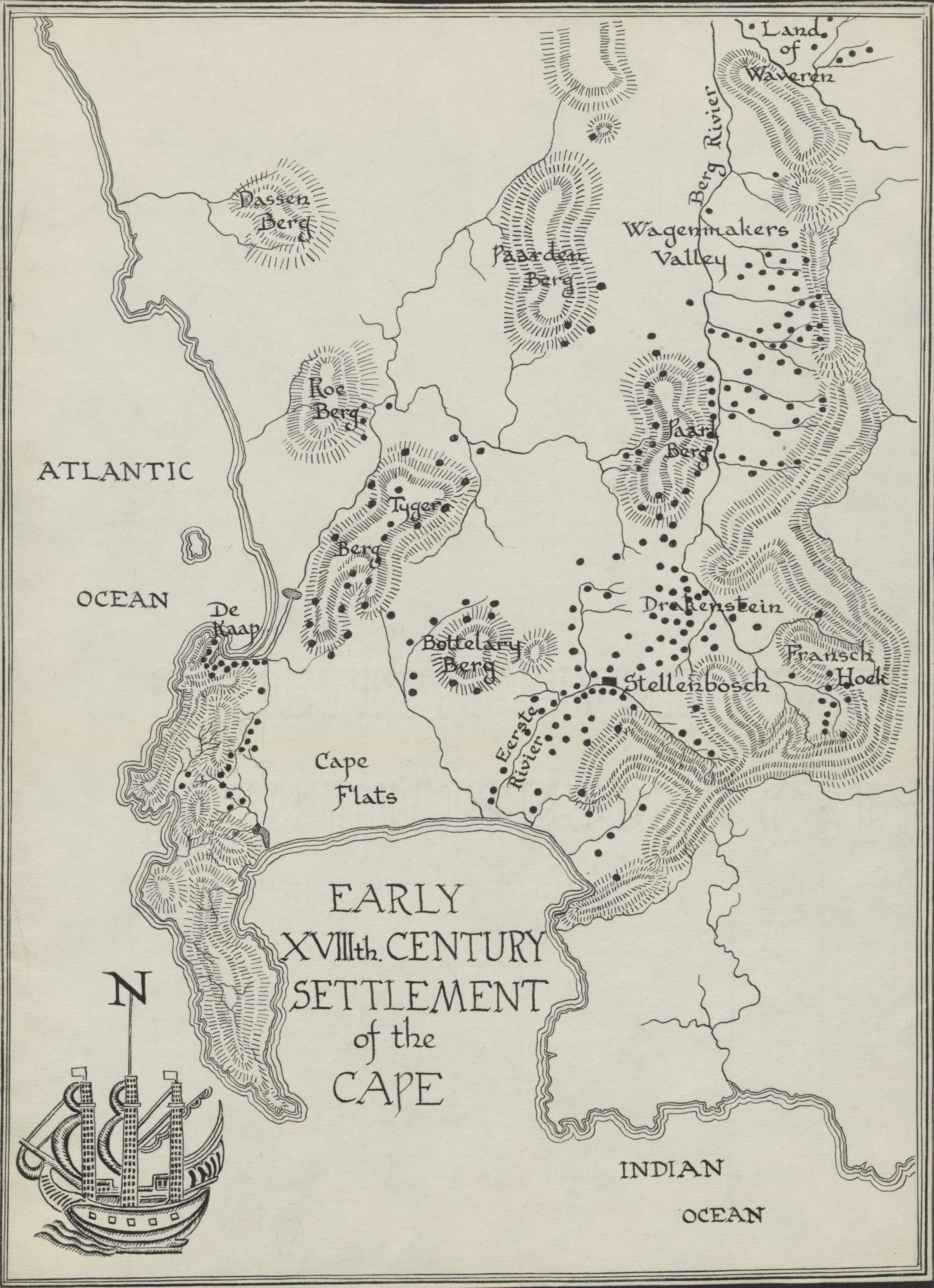
| dc.description | This illustration was published in Homesteads and villages of South Africa by James Walton. Pretoria : Van Schaik, 1965, p.4. | |
| dc.description.abstract | Drawing of an early eighteenth century settlement of the Cape, depicting Cape Flats, De Kaap, Tygerberg, Koeberg, Dassenberg, Paardeberg, Bottelaryberg, Eersterivier, Stellenbosch, Franschhoek, Drakenstein, Paarlberg, Wagenmakers Valley, Bergrivier and Land of Waveren. | |
| dc.format.medium | Ink on paper | |
| dc.language.iso | en | |
| dc.rights | This item is subject to copyright protection. Reproduction of the content, or any part of it, other than for research, academic or non-commercial use is prohibited without prior consent from the copyright holder. | |
| dc.subject | Cape of Good Hope (South Africa) -- Pictorial works | en_ZA |
| dc.subject | Cape of Good Hope (South Africa) -- Maps | en_ZA |
| dc.subject | Land settlement patterns -- Cape of Good Hope (South Africa) | en_ZA |
| dc.subject | Walton, James, 1911-1999 -- Drawings | en_ZA |
| dc.title | Map of an early eighteenth century settlement of the Cape | en_ZA |
| dc.type | Image | en_ZA |
| dc.rights.holder | Copyright James Walton | |