Hugh Solomon Map Collection
These historical maps, primarily of Africa, form part of the Hugh Solomon Collection which was donated to the Library and Information Service in the 1960’s. Hugh Ross Solomon (1876-1956) was a Johannesburg lawyer who inherited the Africana collection of his father, Sir Edward Philip Solomon, and in his own lifetime added much to the collection. The maps in the collection were all printed before 1860. The digitisation of this collection was made possible by funding from the Carnegie Corporation of New York.
Items in this collection are subject to copyright protection. Reproduction of the content, or any part of it, other than for research, academic or non-commercial use is prohibited without prior consent from the copyright holder. Copyright Stellenbosch University.
Recent Submissions
-
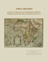
Africa imagined : a selection of maps from the Hugh Solomon Collections Stellenbosch University Library and Information Service
An introduction on the Hugh Solomon map collection and descriptions and depictions of 18 selected maps from the collection. -
Cape of Good Hope (sea chart). [unidentified]
Manuscript coloured chart. 3 insets : 1,"Aldus vertoondt Caap de Bona Esperanca als men uijt de west komt aan zijlen, gelekent op schip Westerdycks loertroen (?) 24 February Ao. 1720". - 2, "Taffel baaij...". - 3, "Aldus ... -
Cape of Good Hope
(J. Arrowsmith, 1842)Coloured map with overlay 24x12cm. Line scale given. An overlay continues the coastline north from Port Natal (Durban) to Delagoa Bay. The first ed. of this map appeared in 1834. -
Grahams Town and the out posts
(James Wyld, 1851)Coloured map. London. Published by James Wyld. Geographer to the Queen & H.R.H. Prince Albert, Charing Cross East. 3rd edition May 3rd., 1851. Below map: Pubd. by Jas. Wyld. March 6th. 1851. -
Geographia sacra
Coloured map. [Scale not given] 3 decorated insets:- 1, Giving authorities.- 2, Map of the world.- 3, In bottom right corner: Reverendo et illustridno Gulielmo Grimbergio, Antverpiensi praesuli dignissimo... This map ... -
Western Africa
(John Tallis & company, 1851)Map. Line scale given. 4 inset vignettes and a medallion above Sierra Leone in bottom left corner. Some boundaries have been added by hand in yellow watercolour. -
North Africa
Coloured maps. Upper half of a sheet with "South Africa." Shows routes taken by Browne, Horneman, Bruce, Park. Lower half of a sheet with "North Africa.". Map is extended beyond the top border to include the Orange ... -
The South Part of Africa, and the Island Madagascar
Coloured map. Line scale given. Page number top right: 44 Appeared in eds. pub. 1729-1735 of H. Moll's "Atlas minor." 1732 is written in pencil in bottom right corner. -
Aevi veteris, typus geographicus
Coloured map. Scale not given. Title at foot of map: En spectator, pilae totius terrae inchnographiam... Map is in form of a globe with a decorated border with circular insets in each corner (Europe, America, Asia and ... -
Cape Colony
(John Tallis & Company, 1851)Coloured map. 5 inset vignettes and a medallion above Cape Town in bottom left corner. Some boundaries have been added by hand in water colour, blue and yellow. -
St. Helena
Coloured map on sheet. Line scale given. Upper half of a sheet with "The Bay of Agoa de Saldanha..." Page number top right, 43. Appeared in eds. pub. 1729-1735 of H. Moll's "Atlas minor." 1732 is written in pencil ... -
Palaestinae
Coloured map. Line scale given. Decorated inset in top left corner gives the authorities for the map. Latin text on verso: Palestina. First appeared in A. Ortelius: Theatrum orbis terrarum, Additamentum III(Parergon) ... -
Nieuwe Kaart van de Kaap der Goede Hoope en der na by gelegen Landen
(Is. Tirion, 1763)Coloured map. Line scale given in bottom left corner in "Fransche Toises, of halve Roeden." This map (uncoloured) appears in "Hedendaagsche historie of tegenwoordige staat van Afrika", pub. Amsterdam, I. Tirion, 1763, p.683. -
False Bay (sea chart). [unidentified]
Manuscript coloured chart. Decorated cartouche with title is towards the lower right. On the right of this is an empty decorated frame, probably intended for a dedication. Below this are 2 drawings of the mountains of ... -
Natal and Kaffraria
(Tallis (John) & Co., 1851)Coloured map. Line scale given. 2 inset vignettes: "Entrance to Port Natal", and Town of Durban with medallion above of the seal of Natal. Some boundaries have been added by hand in water colour, in blue and yellow. -
A mapp of the higher and lower Aethiopia
Map. In top right corner is a heraldic dedication to Sr. William Glynne of Bissister, signed R.B. In lower right corner: Francis Lamb Sculp. This map is an exact copy on a slightly smaller scale of Sanson's map of ... -
Vergelegen
Drawing from Korte Deductie van Willem Adriaan van der Stel...tot destructie ende wederlegginge van alle de klaghten, die enige vry-luyden vande voorsz. Cabo, aen de Edele Achtbare Heren bewinthebberen. -
-
Aegyptus antiqua
Coloured map. First appeared in Theatrum orbis terrarum, Additamentum V (Parergon)of 1595. 2 insets, 1 giving details of the coast between Alexandria and Heraclium; the other inset oval in shape and coloured yellow, ... -
L'Afrique divisee en ses principaux etats
Coloured map. Scale not given. Above top right corner: No. 28 Title within cartouche bottom left with palm trees, crocodile etc.