Search
Now showing items 1-10 of 48
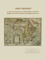
Africa imagined : a selection of maps from the Hugh Solomon Collections Stellenbosch University Library and Information Service
An introduction on the Hugh Solomon map collection and descriptions and depictions of 18 selected maps from the collection.

A mapp of the higher and lower Aethiopia
Map.
In top right corner is a heraldic dedication to Sr. William Glynne of Bissister, signed R.B.
In lower right corner: Francis Lamb Sculp.
This map is an exact copy on a slightly smaller scale of Sanson's map of ...

Africae nova descriptio
Coloured map.
Scale not given.
Latin text on the reverse (incomplete) differs from that of Atlas major pub. by his son Johan Blaeu in 1662. This map may be from an ed. of the Appendix theatri... first pub. in 1631, or ...

Africa
Coloured map.
Scale not given.
Title is given in bottom right corner & is not enclosed in a cartouche. On lower left side are 2 notes, 1 on "St. Helena” & the other on the "Cape of Good Hope". In the middle of Africa ...

Africae Tabula Nova
Coloured map.
Scale not given.
col.map 37x50cm.
First appeared in A. Ortelius: Theatrum orbis terrarum of 1570.
Simple cartouche with 2 armless statues of women; above the title is inscribed: Africam Graeci Lybyam ...

L'Afrique divisee en ses principaux etats
Coloured map.
Scale not given.
Above top right corner: No. 28
Title within cartouche bottom left with palm trees, crocodile etc.

Carte reduite d'une partie des Costes Occidentales et Meridionales de l'Afrique
Chart.
Scale not given.
Title within large cartouche bottom left, surmounted by the arms of France. 3 silhouettes of the coast top right: Vue du Cap de Bonne Esperance, Vue du Cap Falso, Autre Vue du Cap Falso.
This ...

Africa Secundum legitimas Projectionis Stereographicae regulas
Coloured map.
Scale not given.
Title within large cartouche (uncoloured) bottom left with figures of Europeans & natives, lions, elephant, rhinoceros etc. This map is a re-engraving of the 1737 ed. as there are changes ...

Africa
Coloured map on sheet 35x22cm.
On verso: Barbary and Bildulgerid; A map of Zaara. Negroe-land. Guinea...
Page number top right, 133; headed "A general and particular description of Africa."
This sheet of maps ...

A new and accurate map of Africa
Coloured map.
At top of map: Engraved for Bankes's New System of Geography, Published by Royal Authority. First appeared in Middelton's "New and Complete system of Geography", 1777-78, and was reissued for Bankes "Geography" ...