| dc.contributor | Homann Heirs, firm | |
| dc.coverage.spatial | Africa | |
| dc.coverage.temporal | 1737 | |
| dc.date.accessioned | 2012-10-11T10:19:45Z | |
| dc.date.available | 2012-10-11T10:19:45Z | |
| dc.date.created | 1737 | |
| dc.identifier.other | Map no. 17 | |
| dc.identifier.uri | http://hdl.handle.net/10019.2/747 | |
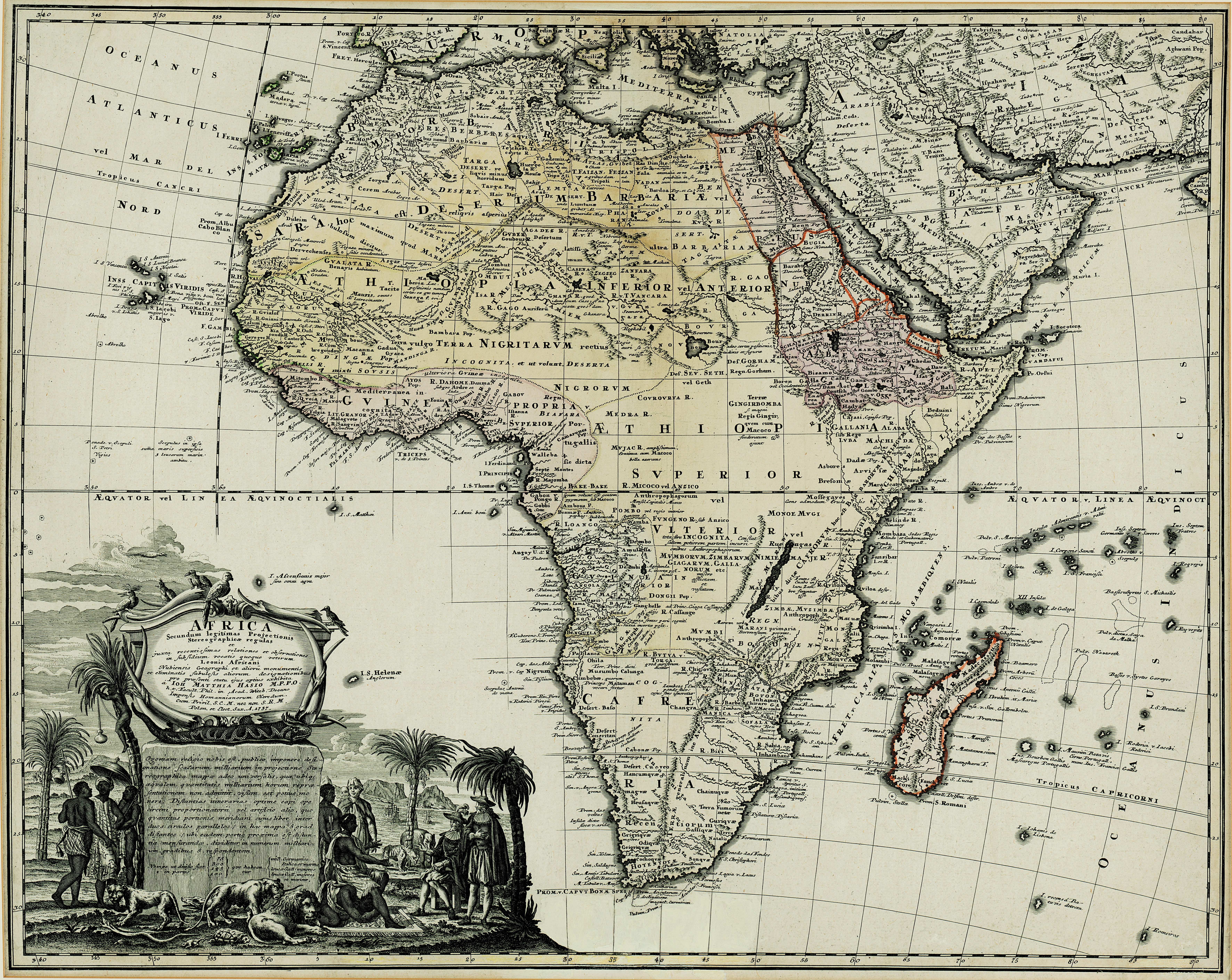
| dc.description.abstract | Coloured map.
Scale not given.
Title within large cartouche (uncoloured) bottom left with figures of Europeans & natives, lions, elephant, rhinoceros etc. This map is a re-engraving of the 1737 ed. as there are changes in type eg: "Prom V Caput Bonae Spei" is now in 1 line, see Tooley: Collectors' handbook to maps of Africa, 1969, p.52. This map has been cut down so it might be a copy of the ed. which has "Noribergae in Officina Homanniana" added bottom left below the border. | |
| dc.format.extent | 47 x 58cm | |
| dc.language.iso | la | |
| dc.rights | This item is subject to copyright protection. Reproduction of the content, or any part of it, other than for research, academic or non-commercial use is prohibited without prior consent from the copyright holder. | |
| dc.source | Map from Hugh Solomon Collection, Africana. | |
| dc.subject | Africa -- Maps -- Early works to 1800 | en_ZA |
| dc.subject | Cartography -- Africa | en_ZA |
| dc.title | Africa Secundum legitimas Projectionis Stereographicae regulas | la |
| dc.type | Map | |
| dc.rights.holder | Copyright Stellenbosch University | |