| dc.contributor | Visscher, Nicolaes, 1649-1702 | |
| dc.coverage.spatial | Africa | |
| dc.coverage.temporal | 1680 | |
| dc.date.accessioned | 2012-10-11T10:19:46Z | |
| dc.date.available | 2012-10-11T10:19:46Z | |
| dc.date.created | 1680 | |
| dc.identifier.other | Map no. 36 | |
| dc.identifier.uri | http://hdl.handle.net/10019.2/775 | |
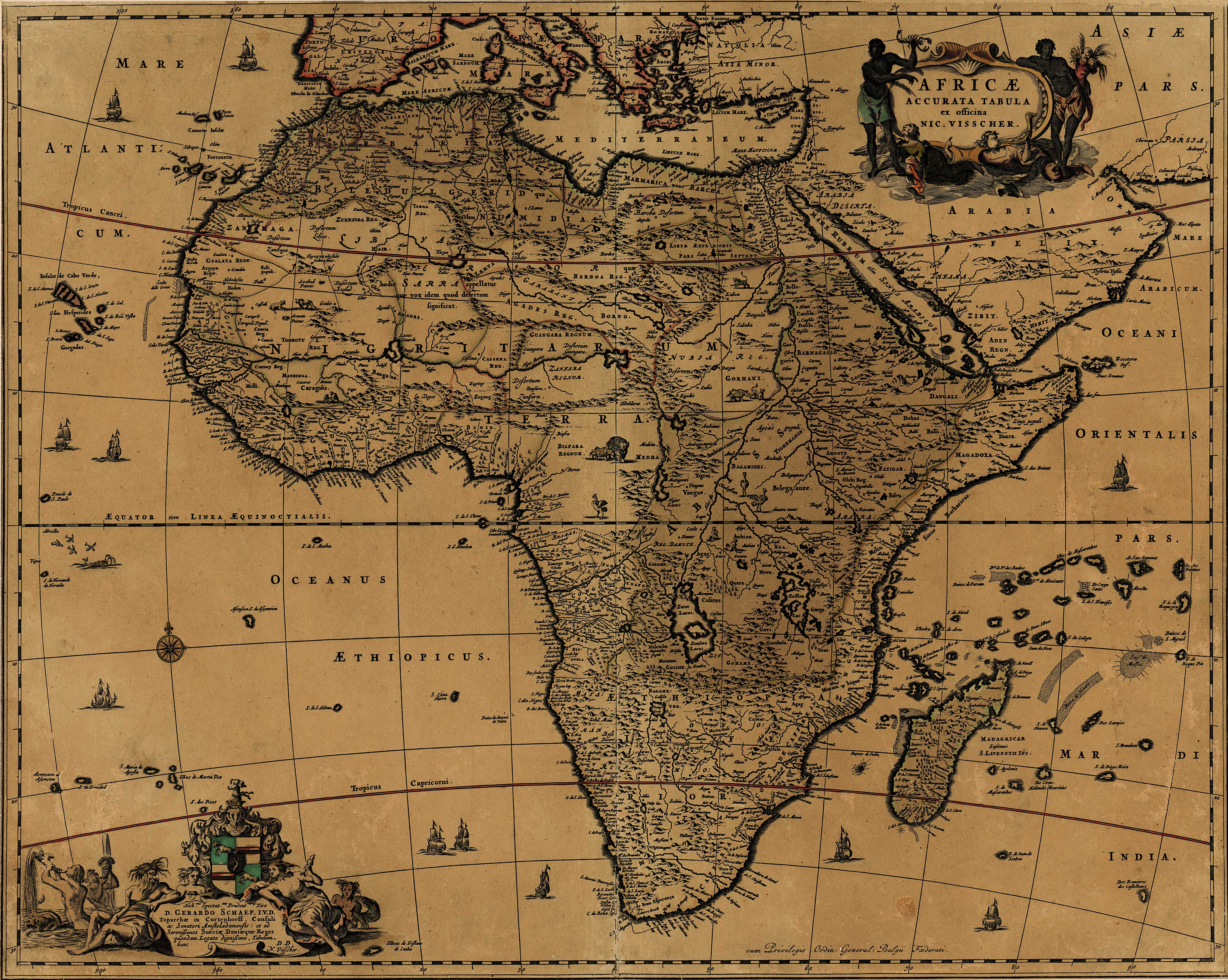
| dc.description.abstract | Coloured map.
Scale not given.
Title within cartouche top right, with a negro on either side & 2 angels below. Decorative dedication bottom left, to Gerard Schaep.
At foot of map on the right: Cum Privilegio Ordin: General: Belgii Federati.
This map appears in an "Atlas contractus" pub. about 1680 by Nicolas Visscher (II), grandson of Claes Jansz. Visscher, the founder of this Dutch family of cartographers. | |
| dc.format.extent | 54 x 43,5cm | |
| dc.language.iso | la | |
| dc.rights | This item is subject to copyright protection. Reproduction of the content, or any part of it, other than for research, academic or non-commercial use is prohibited without prior consent from the copyright holder. | |
| dc.source | Map from Hugh Solomon Collection, Africana. | |
| dc.subject | Africa -- Maps -- Early works to 1800 | en_ZA |
| dc.subject | Cartography -- Africa | en_ZA |
| dc.title | Africae accurata tabula | la |
| dc.type | Map | |
| dc.rights.holder | Copyright Stellenbosch University | |