| dc.contributor | Thornton, John, 1641-1708 | |
| dc.coverage.spatial | Cape of Good Hope | |
| dc.coverage.temporal | 1675-1703 | |
| dc.date.accessioned | 2012-10-11T10:19:46Z | |
| dc.date.available | 2012-10-11T10:19:46Z | |
| dc.date.created | 1675-1703 | |
| dc.identifier.other | Map no. 90 | |
| dc.identifier.uri | http://hdl.handle.net/10019.2/781 | |
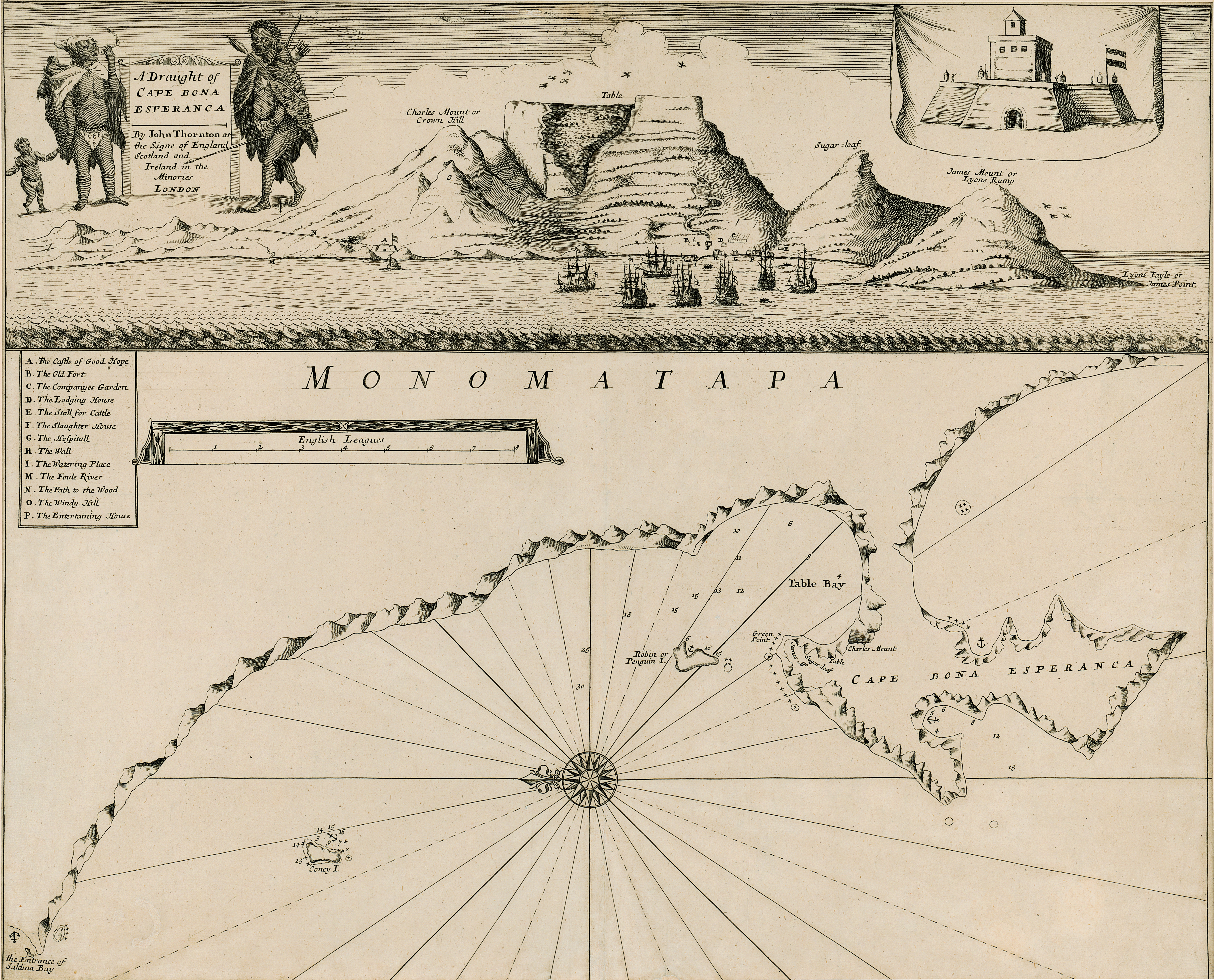
| dc.description.abstract | Chart.
Line scale given.
This map with some changes is a new ed. of that issued by John Seller in 1675. Seller & Thornton collaborated from 1675 onwards & produced several works including “The English pilot" in which this map appears in 1703.
Title cartouche top left is new & has 2 figures of natives, the one on left with 2 children smoking a pipe; figure on the right has a spear & arrows. The view of Table Bay & the Fort across the top of the map are the same. The map is redrawn; the scale is in a simple frame & a key A-P is added. | |
| dc.format.extent | 44 x 53cm | |
| dc.language.iso | en | |
| dc.rights | This item is subject to copyright protection. Reproduction of the content, or any part of it, other than for research, academic or non-commercial use is prohibited without prior consent from the copyright holder. | |
| dc.source | Map from Hugh Solomon Collection, Africana. | |
| dc.subject | Cape of Good Hope (South Africa) -- Maps | en_ZA |
| dc.subject | South Africa -- Maps -- Early works to 1800 | en_ZA |
| dc.subject | Cartography -- South Africa -- Cape of Good Hope | en_ZA |
| dc.title | A draught of Cape Bona Esperanca | en |
| dc.type | Map | |
| dc.rights.holder | Copyright Stellenbosch University | |