| dc.contributor | Ortelius, Abraham, 1527-1598 | |
| dc.coverage.spatial | Egypt | |
| dc.coverage.temporal | 1595 | |
| dc.date.accessioned | 2012-10-11T10:19:48Z | |
| dc.date.available | 2012-10-11T10:19:48Z | |
| dc.date.created | 1595 | |
| dc.identifier.other | Map no. 46 | |
| dc.identifier.uri | http://hdl.handle.net/10019.2/818 | |
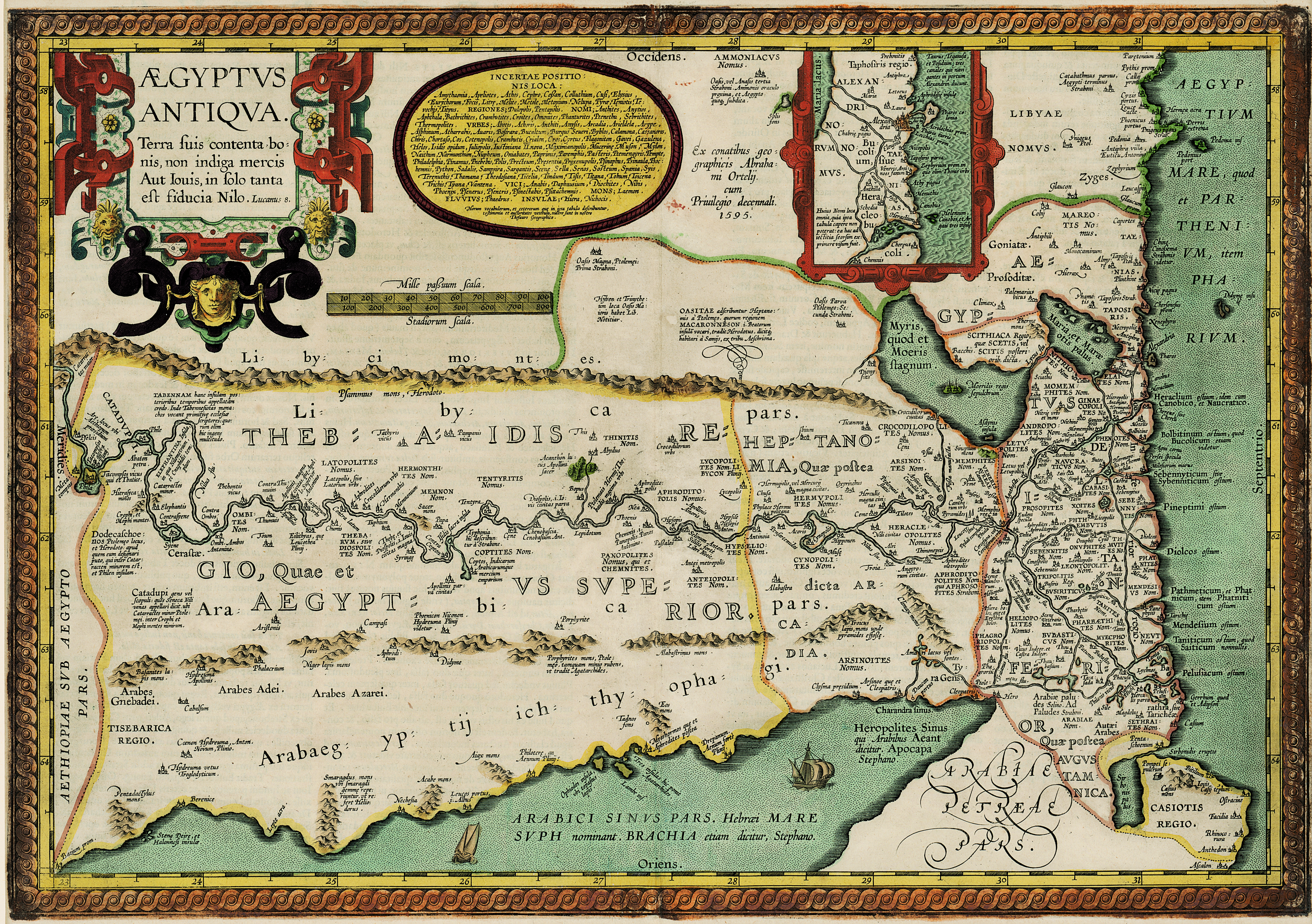
| dc.description.abstract | Coloured map.
First appeared in Theatrum orbis terrarum, Additamentum V (Parergon)of 1595.
2 insets, 1 giving details of the coast between Alexandria and Heraclium; the other inset oval in shape and coloured yellow, gives the authorities for the map.
Latin text on verso: Aegyptus. | |
| dc.format.extent | 36 x 51cm | |
| dc.language.iso | la | |
| dc.rights | This item is subject to copyright protection. Reproduction of the content, or any part of it, other than for research, academic or non-commercial use is prohibited without prior consent from the copyright holder. | |
| dc.source | Map from Hugh Solomon Collection, Africana. | |
| dc.subject | Egypt -- Maps -- Early works to 1800 | en_ZA |
| dc.subject | Cartography -- Egypt | en_ZA |
| dc.title | Aegyptus antiqua | la |
| dc.type | Map | |
| dc.rights.holder | Copyright Stellenbosch University | |
| dc.description.featured | true | en_ZA |