| dc.contributor | Visscher, Nicolaes, 1649-1702, widow of | |
| dc.coverage.spatial | Africa | |
| dc.coverage.temporal | 1710 | |
| dc.date.accessioned | 2012-10-11T10:19:48Z | |
| dc.date.available | 2012-10-11T10:19:48Z | |
| dc.date.created | 1710 | |
| dc.date.issued | 1710 | |
| dc.identifier.other | Map no. 67 | |
| dc.identifier.uri | http://hdl.handle.net/10019.2/831 | |
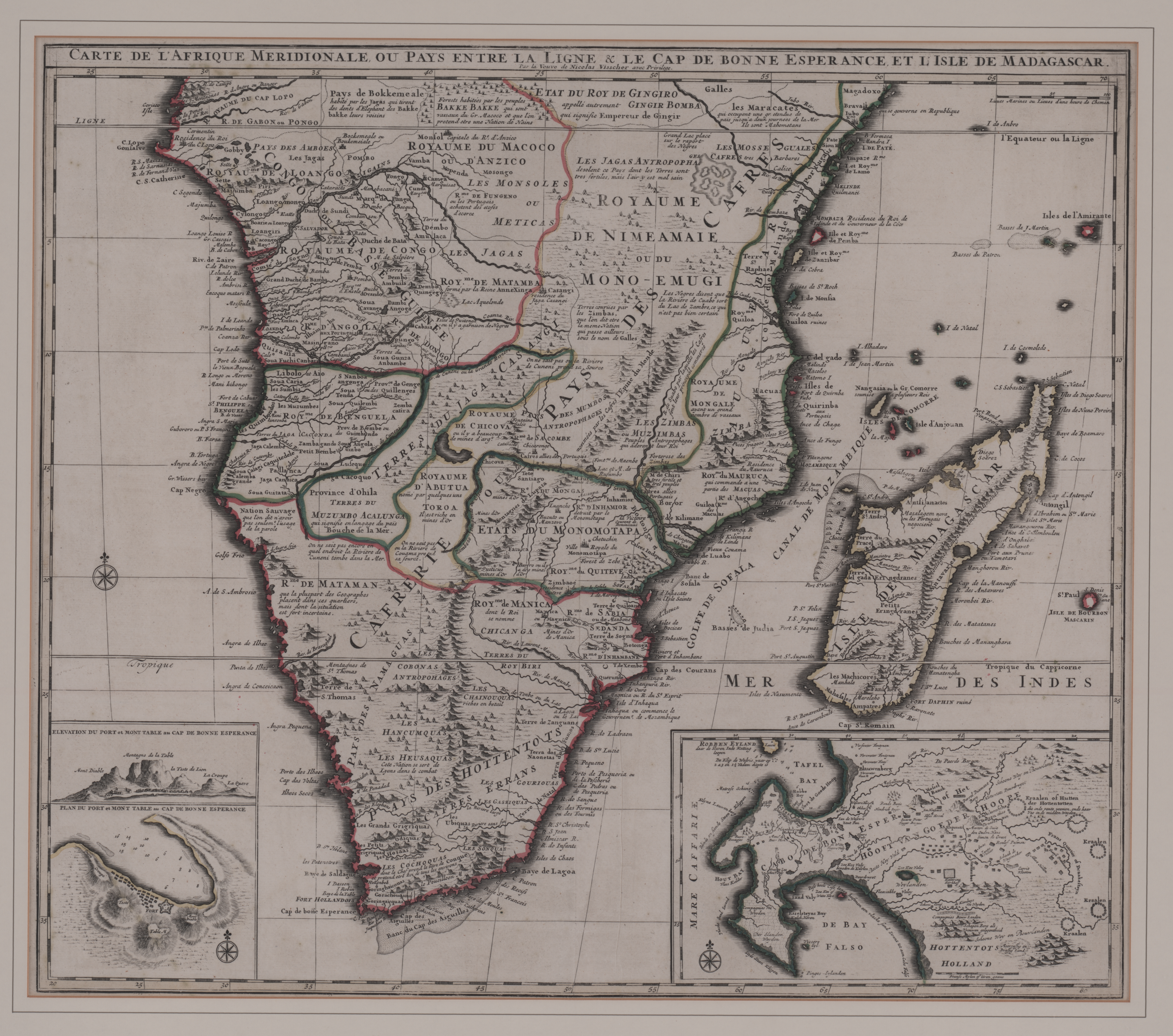
| dc.description.abstract | Coloured map.
Line scale given.
3 insets: 1, "Elevation du port et Mont Table au Cap de Bonne Esperance." - 2, "Plan du port et Mont Table au Cap de Bonne Esperance." - 3, in the right hand lower corner is an enlarged map of the Cape and its vicinity, but without a caption. This gives detailed information about the various settlements including the names of farmers.
First appeared in F. de Wit: Atlas major, Amsterdam, c.1705; was later pub. by the widow Visscher in "Atlas minor..." in c.1717.
Appears in E. Klemp: Africa on maps dating from the 12th to the 18th century, 1968 (no.67), fully col. | |
| dc.format.extent | 51 x 58cm | |
| dc.language.iso | fr | |
| dc.publisher | Nicolas Visscher | |
| dc.rights | This item is subject to copyright protection. Reproduction of the content, or any part of it, other than for research, academic or non-commercial use is prohibited without prior consent from the copyright holder. | |
| dc.source | Map from Hugh Solomon Collection, Africana. | |
| dc.subject | Africa -- Maps -- Early works to 1800 | en_ZA |
| dc.subject | Cartography -- Africa | en_ZA |
| dc.title | Carte de l'Afrique meridionale | fr |
| dc.type | Map | |
| dc.rights.holder | Copyright Stellenbosch University | |