| dc.contributor | Ortelius, Abraham, 1527-1598 | |
| dc.coverage.spatial | Palestine | |
| dc.coverage.temporal | 1584 | |
| dc.date.accessioned | 2012-10-11T10:19:49Z | |
| dc.date.available | 2012-10-11T10:19:49Z | |
| dc.date.created | 1584 | |
| dc.identifier.other | Map no. 96 | |
| dc.identifier.uri | http://hdl.handle.net/10019.2/846 | |
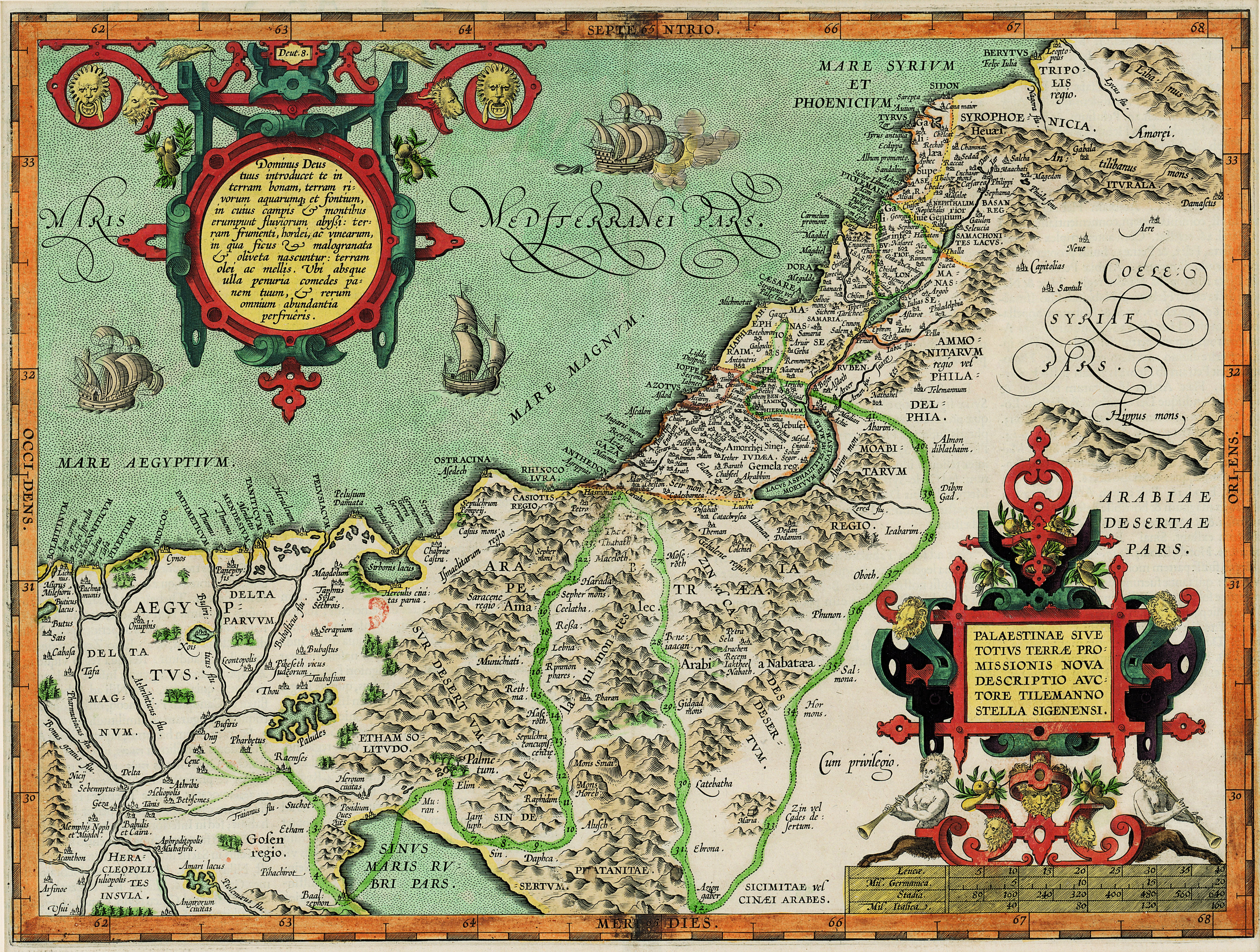
| dc.description.abstract | Coloured map.
Line scale given.
Decorated inset in top left corner gives the authorities for the map.
Latin text on verso: Palestina.
First appeared in A. Ortelius: Theatrum orbis terrarum, Additamentum III(Parergon) of 1584. Ortelius's name is not given on this map, nor a date. | |
| dc.format.extent | 34 x 45cm | |
| dc.language.iso | la | |
| dc.rights | This item is subject to copyright protection. Reproduction of the content, or any part of it, other than for research, academic or non-commercial use is prohibited without prior consent from the copyright holder. | |
| dc.source | Map from Hugh Solomon Collection, Africana. | |
| dc.subject | Palestine -- Maps -- Early works to 1800 | en_ZA |
| dc.subject | Cartography -- Palestine | en_ZA |
| dc.title | Palaestinae | la |
| dc.type | Map | |
| dc.rights.holder | Copyright Stellenbosch University | |