| dc.contributor | Ortelius, Abraham, 1527-1598 | |
| dc.coverage.temporal | 1590 | |
| dc.date.accessioned | 2012-10-11T10:19:49Z | |
| dc.date.available | 2012-10-11T10:19:49Z | |
| dc.date.created | 1590 | |
| dc.identifier.other | Map no. 97 | |
| dc.identifier.uri | http://hdl.handle.net/10019.2/847 | |
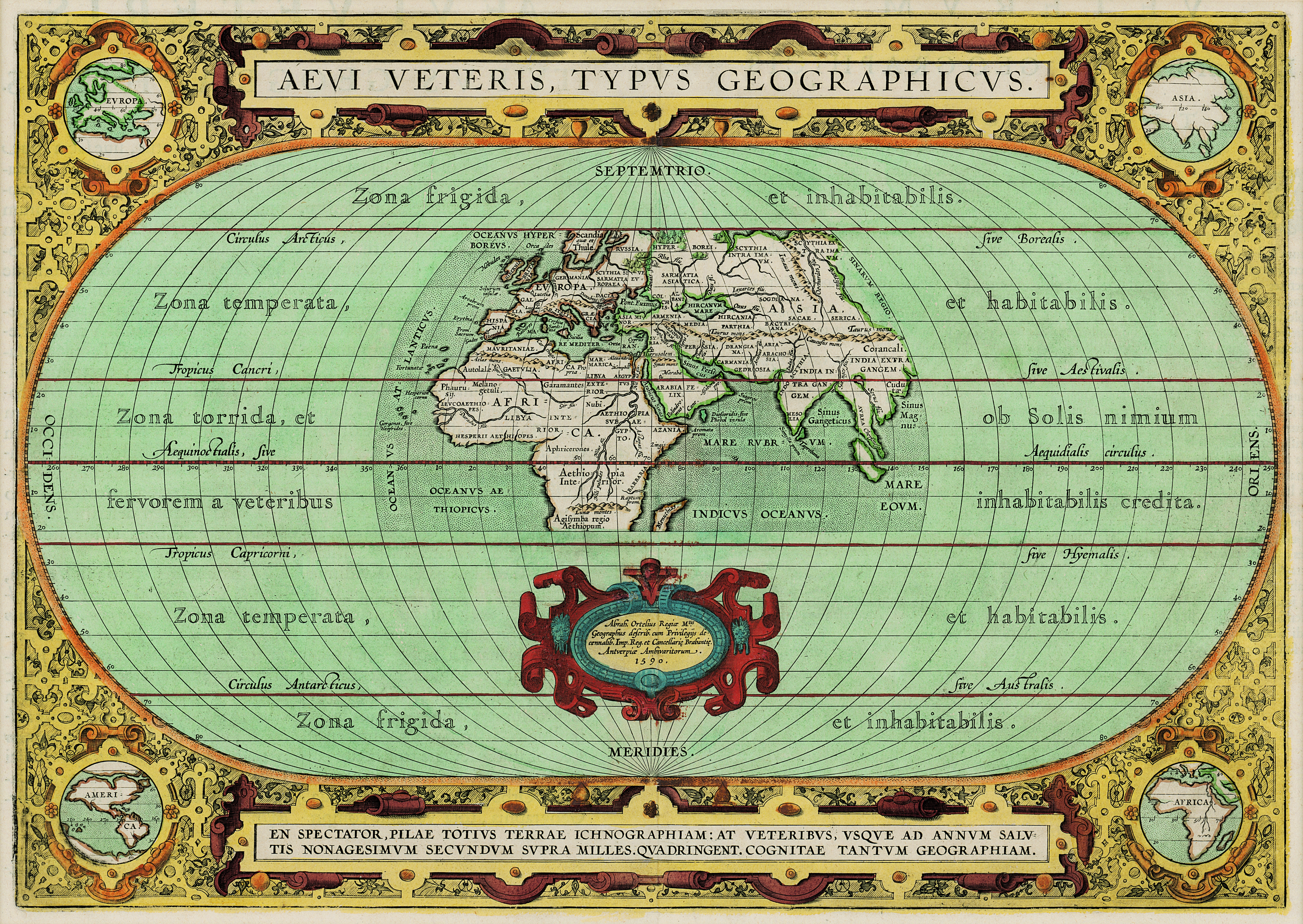
| dc.description.abstract | Coloured map.
Scale not given.
Title at foot of map: En spectator, pilae totius terrae inchnographiam...
Map is in form of a globe with a decorated border with circular insets in each corner (Europe, America, Asia and Africa).
Latin text on verso: Aevi veteris typus geographicus.
First appeared in Theatrum orbis terrarum. Additamentum IV (Parergon) of 1590. | |
| dc.format.extent | 31 x 44cm | |
| dc.language.iso | la | |
| dc.rights | This item is subject to copyright protection. Reproduction of the content, or any part of it, other than for research, academic or non-commercial use is prohibited without prior consent from the copyright holder. | |
| dc.source | Map from Hugh Solomon Collection, Africana. | |
| dc.subject | World maps -- Early works to 1800 | en_ZA |
| dc.title | Aevi veteris, typus geographicus | la |
| dc.type | Map | |
| dc.rights.holder | Copyright Stellenbosch University | |