Browsing Hugh Solomon Map Collection by Issue Date
Now showing items 21-40 of 97
-
Grahams Town and the out posts
(James Wyld, 1851)Coloured map. London. Published by James Wyld. Geographer to the Queen & H.R.H. Prince Albert, Charing Cross East. 3rd edition May 3rd., 1851. Below map: Pubd. by Jas. Wyld. March 6th. 1851. -
Africa
(John Tallis & Company, 1851)Coloured map. Differs from 1st ed. of 1850, e.g. bounds of Cape Colony have been extended to Orange River & some names have been altered - Maravi to Nyassi etc. 5 inset vignettes. Some boundaries have been added by ... -
Western Africa
(John Tallis & company, 1851)Map. Line scale given. 4 inset vignettes and a medallion above Sierra Leone in bottom left corner. Some boundaries have been added by hand in yellow watercolour. -
Cape Colony
(John Tallis & Company, 1851)Coloured map. 5 inset vignettes and a medallion above Cape Town in bottom left corner. Some boundaries have been added by hand in water colour, blue and yellow. -
Northern Africa
(John Tallis & Company, 1851)Map. Line scale given. 5 inset vignettes Some boundaries have been added by hand in yellow watercolour. -
Natal and Kaffraria
(Tallis (John) & Co., 1851)Coloured map. Line scale given. 2 inset vignettes: "Entrance to Port Natal", and Town of Durban with medallion above of the seal of Natal. Some boundaries have been added by hand in water colour, in blue and yellow. -
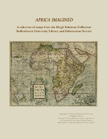
Africa imagined : a selection of maps from the Hugh Solomon Collections Stellenbosch University Library and Information Service
An introduction on the Hugh Solomon map collection and descriptions and depictions of 18 selected maps from the collection. -
Cape of Good Hope (sea chart). [unidentified]
Manuscript coloured chart. 3 insets : 1,"Aldus vertoondt Caap de Bona Esperanca als men uijt de west komt aan zijlen, gelekent op schip Westerdycks loertroen (?) 24 February Ao. 1720". - 2, "Taffel baaij...". - 3, "Aldus ... -
A mapp of the higher and lower Aethiopia
Map. In top right corner is a heraldic dedication to Sr. William Glynne of Bissister, signed R.B. In lower right corner: Francis Lamb Sculp. This map is an exact copy on a slightly smaller scale of Sanson's map of ... -
Vergelegen
Drawing from Korte Deductie van Willem Adriaan van der Stel...tot destructie ende wederlegginge van alle de klaghten, die enige vry-luyden vande voorsz. Cabo, aen de Edele Achtbare Heren bewinthebberen. -
-
Africae nova descriptio
Coloured map. Scale not given. Latin text on the reverse (incomplete) differs from that of Atlas major pub. by his son Johan Blaeu in 1662. This map may be from an ed. of the Appendix theatri... first pub. in 1631, or ... -
Africa
Coloured map. Scale not given. Title is given in bottom right corner & is not enclosed in a cartouche. On lower left side are 2 notes, 1 on "St. Helena” & the other on the "Cape of Good Hope". In the middle of Africa ... -
Africae Tabula Nova
Coloured map. Scale not given. col.map 37x50cm. First appeared in A. Ortelius: Theatrum orbis terrarum of 1570. Simple cartouche with 2 armless statues of women; above the title is inscribed: Africam Graeci Lybyam ... -
Aegyptus antiqua
Coloured map. First appeared in Theatrum orbis terrarum, Additamentum V (Parergon)of 1595. 2 insets, 1 giving details of the coast between Alexandria and Heraclium; the other inset oval in shape and coloured yellow, ... -
L'Afrique divisee en ses principaux etats
Coloured map. Scale not given. Above top right corner: No. 28 Title within cartouche bottom left with palm trees, crocodile etc. -
Aethiopia Inferior, vel Exterior
Coloured map. Line scale given. Title cartouche in bottom right corner, an ox skin supported by 2 natives with tortoises and monkeys at the foot. Two ships are shown off the west coast & 1 off the east coast. This map ... -
Carte reduite d'une partie des Costes Occidentales et Meridionales de l'Afrique
Chart. Scale not given. Title within large cartouche bottom left, surmounted by the arms of France. 3 silhouettes of the coast top right: Vue du Cap de Bonne Esperance, Vue du Cap Falso, Autre Vue du Cap Falso. This ... -
Africa Secundum legitimas Projectionis Stereographicae regulas
Coloured map. Scale not given. Title within large cartouche (uncoloured) bottom left with figures of Europeans & natives, lions, elephant, rhinoceros etc. This map is a re-engraving of the 1737 ed. as there are changes ... -
Carte de L'Isle de Madagascar
Map. Line scales given. Title in plain cartouche bottom left. Plate number top right: No. 93 Stamp in bottom right corner: Depot de la Marine, with the fleur de lys; below the map is the price - trente Sols. Inset: ...