Browsing Images by Title
Now showing items 15-34 of 3792
-
6th Century vessels from Ajanta
Drawing of 6th century vessels from Ajanta, depicting detail of Bhavila's ship and a pleasure boat. -
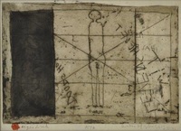
8597 Dood/Leven
(1980) -
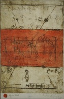
8606 Leven/dood
(1980) -
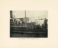
Aankoms by die hawe van sleepboot met Britse soldate en krygsgevangenes
(1900)Photograph depicting British soldiers and prisoners of war, arriving on a tugboat at the harbour at Bermuda Islands. -
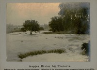
Aapjes rivier bij Pretoria
(Haagsche Pro-Boer Vereeniging, 1900)Photograph depicting the Apies River at Pretoria. -
Abstract head
(1991) -
Abstrak 1
(1982) -
Abstrakte komposisie
(1955) -
Abstrakte komposisie
(1955) -
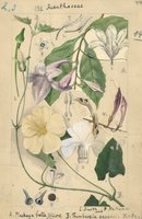
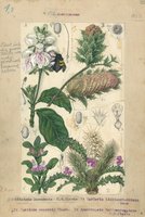
Acanthaceae
(1932)Plate 44 from The flora of South Africa (vol. 3, part 2) featuring Acanthaceae. -
Acanthaceae
(1932)Plate 45 from The flora of South Africa (vol. 3, part 2) featuring Acanthaceae. -
-
Acquiescence
(1971) -
Actor
(1960) -
Aegyptus antiqua
Coloured map. First appeared in Theatrum orbis terrarum, Additamentum V (Parergon)of 1595. 2 insets, 1 giving details of the coast between Alexandria and Heraclium; the other inset oval in shape and coloured yellow, ... -
Aethiopia Inferior, vel Exterior
Coloured map. Line scale given. Title cartouche in bottom right corner, an ox skin supported by 2 natives with tortoises and monkeys at the foot. Two ships are shown off the west coast & 1 off the east coast. This map ... -
Aethiopia Inferior, vel Exterior
Coloured map. Line scale given. Title cartouche in bottom right corner, on ox skin supported by 2 natives with tortoises and monkeys at the foot. Two ships are shown off the west coast & 2 more off the east coast. This ... -
Aevi veteris, typus geographicus
Coloured map. Scale not given. Title at foot of map: En spectator, pilae totius terrae inchnographiam... Map is in form of a globe with a decorated border with circular insets in each corner (Europe, America, Asia and ... -
Africa
Coloured map. Scale not given. Title is given in bottom right corner & is not enclosed in a cartouche. On lower left side are 2 notes, 1 on "St. Helena” & the other on the "Cape of Good Hope". In the middle of Africa ... -
Africa
Coloured map on sheet 35x22cm. On verso: Barbary and Bildulgerid; A map of Zaara. Negroe-land. Guinea... Page number top right, 133; headed "A general and particular description of Africa." This sheet of maps ...